Area Overview for BL9 8DG
Photos of BL9 8DG


Area Information
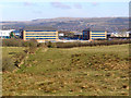
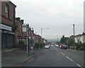
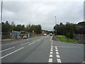
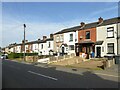
BL9 8DG lies in Unsworth, a village in the Metropolitan Borough of Bury, Greater Manchester. This small residential cluster sits on high ground between Parr Brook and Whittle Brook, with coordinates 53.569002, -2.274821. The area covers 972 acres of former arable land, urbanised primarily in the 1950s. Unsworth’s history stretches to the 13th century, with roots in medieval iron smelting and industrial activity, including cotton mills and brickworks. Today, the population is 1,618, with a quiet, settled character shaped by its proximity to Bury and Manchester. Sunny Bank Road connects to the A56, linking residents to major transport routes. The area’s blend of historical legacy and modern infrastructure makes it a compact, functional community for those seeking a balance between rural tranquility and urban accessibility.
- Area Type
- Postcode
- Area Size
- Not available
- Population
- 1618
- Population Density
- 2763 people/km²
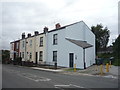
BL9 8DG is an owner-occupied area, with 75% of homes owned by residents rather than rented. The accommodation type is primarily houses, which is typical of small, rural clusters where larger properties dominate. This suggests a limited housing stock, with fewer apartments or high-density developments. For buyers, this means competition for available homes and a focus on individual properties rather than shared spaces. The area’s proximity to Bury and Manchester via the A56 and Sunny Bank Road may enhance its appeal, though the small size of the postcode means buyers should consider nearby areas for broader options.
House Prices in BL9 8DG
No properties found in this postcode.
Energy Efficiency in BL9 8DG
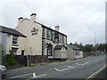
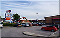
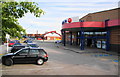
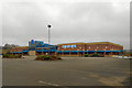
BL9 8DG’s residents have access to a range of amenities within practical reach. Retail options include Iceland Bury, Asda Pilsworth, and Asda Blackford, offering everyday shopping needs. Metro stops like Whitefield and Bury Interchange provide easy access to public transport, while rail stations such as Clifton and Mills Hill connect to broader regional networks. These amenities contribute to a convenient, self-contained lifestyle, with minimal need to travel beyond the immediate area. The presence of multiple retail and transport hubs suggests a community designed for accessibility, supporting both daily errands and longer commutes.
Amenities
Schools
| Rank | School | Type | Entry gender | Ages |
|---|
Explore more schools in this area
Go to Schools tabDemographics
The median age in BL9 8DG is 47, with the majority of residents aged 30–64. Home ownership is high at 75%, reflecting a community of long-term residents. Accommodation is predominantly houses, indicating a low-density, family-oriented environment. The predominant ethnic group is White, though no specific data on diversity or deprivation is provided. This age profile suggests a stable population with established roots, likely comprising professionals and families. The absence of data on deprivation means the area’s economic resilience or challenges remain unquantified, but the high home ownership rate implies a degree of financial stability.
Household Size
Accommodation Type
Tenure
Ethnic Group
Religion
Household Composition
Age
Household Deprivation
NS-SEC
Explore more demographic insights in this area
Go to Demographics tabPlanning
Planning Constraints
- Flood RiskPremium
- Ramsar Wetland SitesPremium
- Area of Outstanding Natural BeautyPremium
- Protected Nature ReservePremium
- Protected WoodlandPremium