Area Overview for BL9 7UD
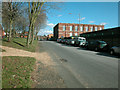
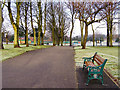
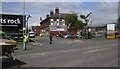
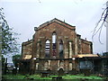
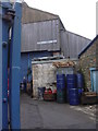
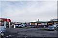
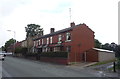
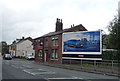
Photos of BL9 7UD

Area Information
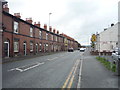
BL9 7UD is a small residential postcode in the Metropolitan Borough of Bury, Greater Manchester, situated near Ramsbottom and historically linked to the East Lancashire Railway. With a population of 1,670, this area reflects a compact, closely knit community. Its origins trace back to Saxon and Roman eras, with the name “Bury” first recorded in the 12th century. The area’s development was shaped by the arrival of the railway in 1846, which spurred growth and connected it to broader networks. Today, BL9 7UD sits near landmarks like Peel Tower and Bury Castle, blending historical significance with modern living. Residents benefit from proximity to Bury’s cultural and transport hubs, including railway stations and retail centres. The area’s small size means it is tightly integrated with surrounding neighbourhoods, offering a mix of traditional architecture and contemporary amenities. For those seeking a place with roots in history yet access to modern infrastructure, BL9 7UD presents a distinctive blend of character and practicality.
- Area Type
- Postcode
- Area Size
- Not available
- Population
- 1670
- Population Density
- 4387 people/km²
BL9 7UD is characterised by a housing stock predominantly consisting of houses, reflecting a traditional residential layout. With a home ownership rate of 18%, the area is not heavily dominated by owner-occupied properties, suggesting a significant presence of rental homes or leasehold arrangements. This low ownership percentage may indicate a market where property investment is less common, or where residents opt for long-term rental agreements. The small size of the postcode means the housing stock is limited, and buyers should consider the immediate surrounding areas for broader options. For those seeking a home in BL9 7UD, the focus is likely on individual properties rather than larger developments. The predominance of houses may appeal to families or those preferring detached living, though the small scale of the area means competition for properties could be keen. Prospective buyers should also note the proximity to Bury’s transport and retail hubs, which may influence property desirability and value.
House Prices in BL9 7UD
No properties found in this postcode.
Energy Efficiency in BL9 7UD
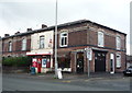
Living in BL9 7UD provides access to a range of amenities within practical reach, enhancing daily life. Retail options include Aldi Fernhill, Spar, and Iceland Bury, offering convenience for grocery shopping. The area’s proximity to Bury Interchange and multiple railway stations, such as Rochdale and Mills Hill, ensures easy access to public transport, supporting both local and regional travel. While the data does not specify parks or leisure facilities, the area’s historical sites—like Peel Tower and Bury Castle—add cultural value. The presence of multiple retail and transport hubs suggests a functional, community-oriented lifestyle. Residents can enjoy the blend of practical amenities and historical richness, though the absence of detailed information on leisure options means further exploration may be needed. Overall, BL9 7UD offers a balance of convenience and heritage, suitable for those valuing accessibility and local character.
Amenities
Schools
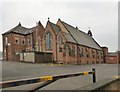
Residents of BL9 7UD have access to a range of educational institutions, including Hoyle Nursery School, which provides early years education. For primary education, St Joseph and St Bede RC Primary School serves the area, with a second iteration listed as a Voluntary Academy, indicating a potential focus on faith-based or academically specialised provision. Cambian Chesham House School offers special education services, with an Ofsted rating of satisfactory, suggesting it meets baseline standards but may not excel in all areas. The mix of nursery, primary, and special schools caters to diverse educational needs, from early childhood development to tailored support for students with specific requirements. Families with young children benefit from the proximity of these schools, though the absence of secondary schools in the immediate area may require commuting. The presence of both mainstream and specialist education options reflects a community that prioritises accessibility for all learners.
| Rank | School | Type | Entry gender | Ages |
|---|
Explore more schools in this area
Go to Schools tabDemographics
The population of BL9 7UD has a median age of 47, with the majority of residents falling within the 30–64 age range. This suggests a community skewed toward middle-aged adults, likely including families and professionals. Home ownership in the area is relatively low at 18%, indicating a significant proportion of residents may rent their homes. The predominant accommodation type is houses, reflecting a residential character distinct from high-density housing. The predominant ethnic group is White, though no specific data on diversity or deprivation levels is provided. This age profile and housing stock suggest a stable, established community with a focus on long-term residency. The relatively low home ownership rate may imply a rental market, though the exact balance between owner-occupied and rental properties remains unspecified. The area’s demographics align with a mature, settled population, potentially with strong local ties and a focus on community cohesion.
Household Size
Accommodation Type
Tenure
Ethnic Group
Religion
Household Composition
Age
Household Deprivation
NS-SEC
Explore more demographic insights in this area
Go to Demographics tabPlanning
Planning Constraints
- Flood RiskPremium
- Ramsar Wetland SitesPremium
- Area of Outstanding Natural BeautyPremium
- Protected Nature ReservePremium
- Protected WoodlandPremium