Area Overview for BL9 7RU
Photos of BL9 7RU


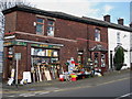


28 photos from this area
Area Information
Key information about the BL9 7RU including its size, population, and administrative classification.
- Area Type
- Postcode
- Area Size
- 1.9 hectares
- Population
- 1450
- Population Density
- 1125 people/km²
House Prices in BL9 7RU
21
Properties
£168,568
Average Sold Price
£43,750
Lowest Price
£320,000
Highest Price
Showing 21 properties
| Address | Type | Beds | Baths | Last Sale Price | Last Sale Date | |
|---|---|---|---|---|---|---|
| 18 Woodgate Avenue, Bury, BL9 7RU | Detached | 4 | 2 | £320,000 | Jul 2024 | |
| 16 Woodgate Avenue, Bury, BL9 7RU | house | - | - | £280,000 | Feb 2021 | |
| 24 Woodgate Avenue, Bury, BL9 7RU | Detached | 4 | 2 | £280,000 | Nov 2018 | |
| 9 Woodgate Avenue, Bury, BL9 7RU | Terraced | 3 | 1 | £75,000 | Apr 2017 | |
| 20 Woodgate Avenue, Bury, BL9 7RU | house | 5 | 3 | £275,000 | Mar 2016 | |
| 22 Woodgate Avenue, Bury, BL9 7RU | Detached | 5 | 1 | £207,000 | Dec 2014 | |
| 1 Woodgate Avenue, Bury, BL9 7RU | Terraced | - | - | £110,000 | Sep 2004 | |
| 26 Woodgate Avenue, Bury, BL9 7RU | house | - | - | £132,000 | Jan 2000 | |
| 4 Woodgate Avenue, Bury, BL9 7RU | Detached | - | - | £86,500 | Dec 1996 | |
| 13 Woodgate Avenue, Bury, BL9 7RU | Terraced | - | - | £43,750 | Sep 1996 |
Page 1 of 3
Energy Efficiency in BL9 7RU
Amenities
Schools
| Rank | School | Type | Entry gender | Ages |
|---|
Explore more schools in this area
Go to Schools tabDemographics
Household Size
Two person
most common
Accommodation Type
Houses
most common
Tenure
72
majority
Ethnic Group
White
most common
Religion
N/A
most common
Household Composition
N/A
most common
Age
47
median
Adults (30-64 years)
most common
Household Deprivation
N/A
with no deprivation
NS-SEC
31
in Lower managerial occupations
Explore more demographic insights in this area
Go to Demographics tabPlanning
Planning Constraints
- Flood RiskPremium
- Ramsar Wetland SitesPremium
- Area of Outstanding Natural BeautyPremium
- Protected Nature ReservePremium
- Protected WoodlandPremium