Area Overview for BL9 7DT
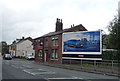
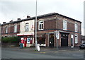
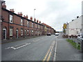
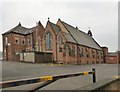
Photos of BL9 7DT
Area Information
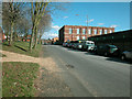
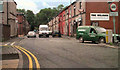
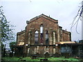
BL9 7DT is a small residential postcode in England, nestled in the Metropolitan Borough of Bury, Greater Manchester. With a population of 2,649, it reflects a compact, close-knit community shaped by its historical roots along the River Irwell and ancient settlement origins. The area is part of the East Lancashire Railway (ELR) region, a legacy of 19th-century industrial expansion that once connected Bury to broader networks. Today, it balances heritage with modern living, offering proximity to landmarks such as Peel Tower, Bury Castle, and St Mary’s Church. The postcode lies near Ramsbottom, a town with a mix of historic architecture and contemporary amenities. Residents benefit from nearby retail hubs, rail links, and primary schools, while the surrounding landscape hints at the area’s Saxon and Roman past. BL9 7DT is ideal for those seeking a blend of historical interest and practical convenience, though its small size means the community is tightly woven, with limited expansion potential.
- Area Type
- Postcode
- Area Size
- Not available
- Population
- Not available
- Population Density
- Not available
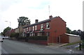
The property market in BL9 7DT is dominated by owner-occupied homes, though the 29% home ownership rate indicates that the majority of properties are rented. The area’s housing stock consists primarily of houses, which are typically larger and more spacious than flats or apartments. This suggests a focus on single-family homes, appealing to those seeking private, detached living. However, the low home ownership percentage implies a rental market that may be competitive, with limited availability of properties for purchase. Given the small size of the postcode, the immediate surroundings are likely to offer similar housing types, making BL9 7DT a niche area for buyers prioritising detached properties. The market’s character is shaped by its historical context, with homes reflecting older architectural styles, though modern developments may be limited due to planning constraints.
House Prices in BL9 7DT
Showing 1 properties
| Address | Type | Beds | Baths | Last Sale Price | Last Sale Date | |
|---|---|---|---|---|---|---|
| Barnbrook Building, Mill Yard, Bury, BL9 7DT | Flat | 1 | 1 | - | - |
Energy Efficiency in BL9 7DT
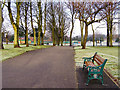
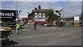
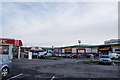
The lifestyle in BL9 7DT is shaped by its proximity to retail, dining, and transport hubs. Nearby venues include Farmfoods Fernhill, M&S Bury, and Iceland Bury, offering a range of shopping and grocery options. The area’s metro and rail stations, such as Bury Interchange and Hall i’ th’ Wood, provide easy access to public transport, facilitating both urban exploration and regional travel. While the data does not specify parks or leisure facilities, the historical context suggests a landscape influenced by Roman roads and ancient sites like Castlesteads promontory fort. The mix of retail, transport, and heritage sites creates a practical, accessible environment, though residents may need to venture further for dedicated leisure spaces. The area’s character is defined by its blend of convenience and historical depth, appealing to those who value both modern amenities and cultural heritage.
Amenities
Schools
BL9 7DT is served by several primary schools, including St Thomas Church of England Primary School, Holy Trinity Primary School, and St Marie’s Roman Catholic Primary School in Bury, which holds an Ofsted rating of ‘good’. Two instances of St Thomas Church of England Primary School and Holy Trinity Primary School are listed, suggesting multiple campuses or repeated entries in the data. The presence of both Church of England and Roman Catholic schools offers families religious and educational choices, though the overall range is limited to primary education. The ‘good’ rating at St Marie’s indicates a school with strong performance, but the absence of secondary schools means parents may need to look beyond the immediate area for comprehensive education. The concentration of primary schools reflects the community’s focus on early years’ education, supporting families with young children.
| Rank | School | Type | Entry gender | Ages |
|---|
Explore more schools in this area
Go to Schools tabDemographics
The population of BL9 7DT has a median age of 47, with the majority of residents aged between 30 and 64 years. This suggests a mature, stable community with a focus on established households. Home ownership in the area is relatively low at 29%, indicating that a significant portion of the population rents their homes. The predominant accommodation type is houses, which aligns with the area’s residential character. The Asian_total ethnic group forms the largest demographic segment, contributing to the cultural diversity of the neighbourhood. While specific data on deprivation is not provided, the low home ownership rate may reflect broader socioeconomic factors influencing housing affordability. The age profile suggests a community with a strong presence of middle-aged adults, which could influence local services and amenities tailored to this demographic.
Household Size
Accommodation Type
Tenure
Ethnic Group
Religion
Household Composition
Age
Household Deprivation
NS-SEC
Explore more demographic insights in this area
Go to Demographics tabPlanning
Planning Constraints
- Flood RiskPremium
- Ramsar Wetland SitesPremium
- Area of Outstanding Natural BeautyPremium
- Protected Nature ReservePremium
- Protected WoodlandPremium