Area Overview for BL9 6WJ
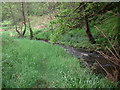
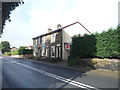
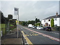
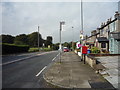
Photos of BL9 6WJ
Area Information
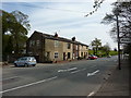
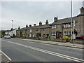
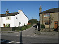
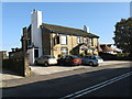
BL9 6WJ lies within the Norden Ward of Rochdale, Greater Manchester, a small residential cluster with a population of 1,512 and a low density of 77 people per square kilometre. Historically part of Lancashire, the area is nestled along the A680 Edenfield Road, connecting Rochdale to Edenfield in Rossendale. The village’s character is shaped by its 19th-century origins as a chapelry of Rochdale, with St Paul’s Church, a Grade II listed building from 1860–1861, standing as a notable landmark. Daily life here is defined by a mature community, with a median age of 47 and a strong presence of adults aged 30–64. The area’s compact size means amenities are closely grouped, offering a quiet, residential atmosphere while remaining within reach of larger urban centres like Rochdale and Bury. Its proximity to transport hubs and retail options balances the tranquillity of village life with practical connectivity.
- Area Type
- Postcode
- Area Size
- Not available
- Population
- 1512
- Population Density
- 77 people/km²
BL9 6WJ is characterised by a high rate of home ownership (68%) and a predominance of houses over flats or other property types. This suggests a market skewed towards owner-occupied homes rather than rental properties, reflecting the area’s appeal to established residents seeking long-term stability. The small size of the postcode area means the housing stock is limited, with properties likely clustered around key local landmarks like St Paul’s Church and the A680 Edenfield Road. For buyers, this implies a need to consider nearby areas for broader options, though the existing stock may offer characterful, family-friendly homes. The absence of high-density housing also means the area maintains a low-rise, residential feel, which may appeal to those seeking space and quiet over urban convenience.
House Prices in BL9 6WJ
No properties found in this postcode.
Energy Efficiency in BL9 6WJ
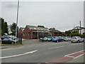
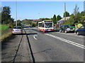
BL9 6WJ offers a range of amenities within practical reach, including five retail venues such as Tesco Heywood, Iceland Heywood, and Morrisons Heywood, ensuring everyday shopping needs are met locally. The area is served by five metro stops and four rail stations, including Castleton and Rochdale, facilitating easy travel to nearby towns. While parks and leisure facilities are not explicitly detailed, the proximity to transport hubs and retail options suggests a lifestyle focused on convenience and connectivity. The compact nature of the area means residents can access essential services without long commutes, while the presence of a primary school and transport links supports both family and professional needs. This blend of local amenities and regional accessibility defines a practical, community-oriented way of life.
Amenities
Schools
The nearest school to BL9 6WJ is St Michael’s Church of England Primary School in Bamford, an outstanding-rated primary school. This institution serves the local community, offering education for younger children in a setting that combines faith-based values with high academic standards. The absence of secondary schools in the immediate vicinity means families may need to look to nearby towns like Rochdale or Heywood for secondary education. However, the presence of an Ofsted-outstanding primary school is a significant advantage for families prioritising early education quality. The school’s location within practical reach of the area reinforces the appeal of BL9 6WJ for households with children, though broader educational planning would require consideration of commuting distances.
| Rank | School | Type | Entry gender | Ages |
|---|
Explore more schools in this area
Go to Schools tabDemographics
The population of BL9 6WJ is predominantly adults aged 30–64, with a median age of 47, reflecting a mature, stable community. Home ownership is high at 68%, with houses forming the primary accommodation type. The predominant ethnic group is White, though specific diversity data is not detailed. This age profile suggests a focus on family life and long-term residency, with fewer young families compared to other areas. The absence of specific deprivation data means quality of life indicators like healthcare access or local services are not quantified, but the area’s low population density and established infrastructure imply a relatively low-pressure environment. The demographic profile aligns with a community prioritising stability and proximity to essential services, though the lack of younger residents may influence local amenities and school demographics.
Household Size
Accommodation Type
Tenure
Ethnic Group
Religion
Household Composition
Age
Household Deprivation
NS-SEC
Explore more demographic insights in this area
Go to Demographics tabPlanning
Planning Constraints
- Flood RiskPremium
- Ramsar Wetland SitesPremium
- Area of Outstanding Natural BeautyPremium
- Protected Nature ReservePremium
- Protected WoodlandPremium