Area Overview for BL9 6FE
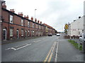
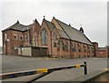
Photos of BL9 6FE


Area Information
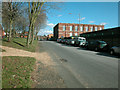
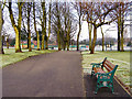
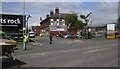
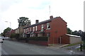
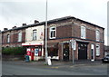
BL9 6FE is a small residential postcode area in England, nestled within the Metropolitan Borough of Bury in Greater Manchester. With a population of 1,776 and a density of 1,174 people per square kilometre, it is a compact, tightly knit community. The area is part of the Moorside Ward, a historically significant electoral district with ties to local heritage and industry. Daily life here is shaped by its proximity to Bury’s urban core, offering a balance between suburban tranquillity and access to regional amenities. Residents benefit from nearby transport links, including railway stations and bus routes, which connect them to Greater Manchester’s broader network. The area’s compact size means most essentials are within practical reach, though its character is defined by a mix of older housing stock and community-focused green spaces like Clarence Park. For those considering living in BL9 6FE, the area’s low flood risk and absence of environmental constraints make it a practical choice, though the high crime risk requires careful consideration.
- Area Type
- Postcode
- Area Size
- Not available
- Population
- 1776
- Population Density
- 1174 people/km²
The property market in BL9 6FE is characterised by a 52% home ownership rate, with houses forming the predominant accommodation type. This suggests a market skewed towards owner-occupied properties rather than rental units, though the exact proportion of rentals is not specified. The presence of houses, rather than flats or apartments, implies a focus on family-friendly or semi-detached housing, typical of suburban areas. Given the area’s compact size and limited expansion potential, property values may be influenced by proximity to transport links and local amenities. Buyers should consider the age of housing stock, as newer developments are not mentioned. The small population and low population density may also mean limited competition for properties, though the high crime risk could impact desirability. For those seeking a home in BL9 6FE, the market offers a mix of established homes in a low-flood-risk area, but buyers must weigh this against safety concerns.
House Prices in BL9 6FE
No properties found in this postcode.
Energy Efficiency in BL9 6FE
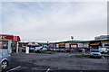
Living in BL9 6FE offers access to a range of local amenities within practical reach. Retail options include Co-op Walmersley, Aldi Fernhill, and Farmfoods Fernhill, providing everyday shopping needs. The area’s transport links connect residents to Bury’s urban centres, where more extensive retail and dining options are available. Nearby green spaces, such as Clarence Park, offer recreational opportunities and a sense of community. While the data does not specify leisure facilities like gyms or cinemas, the presence of multiple railway stations and bus routes suggests proximity to larger entertainment hubs in Bury and Manchester. The compact nature of the area means most errands can be completed without long commutes, though the lack of detailed information on dining or cultural venues leaves some aspects of the lifestyle undefined.
Amenities
Schools
| Rank | School | Type | Entry gender | Ages |
|---|
Explore more schools in this area
Go to Schools tabDemographics
The population of BL9 6FE skews towards adults aged 30–64, with a median age of 47. This suggests a community of established professionals and families, rather than students or retirees. Home ownership rates stand at 52%, indicating a moderate mix of owner-occupied and rental properties. The predominant accommodation type is houses, reflecting a residential area with more traditional housing than flats or apartments. The majority of residents identify as White, with no specific data provided on other ethnic groups. While no deprivation data is explicitly stated, the age profile and housing stock suggest a stable, middle-aged population with established roots. This demographic may prioritise stability and proximity to services over transient living arrangements. The absence of specific diversity metrics means the community’s cultural composition remains less defined in the data.
Household Size
Accommodation Type
Tenure
Ethnic Group
Religion
Household Composition
Age
Household Deprivation
NS-SEC
Explore more demographic insights in this area
Go to Demographics tabPlanning
Planning Constraints
- Flood RiskPremium
- Ramsar Wetland SitesPremium
- Area of Outstanding Natural BeautyPremium
- Protected Nature ReservePremium
- Protected WoodlandPremium