Area Overview for BL9 6EP
Photos of BL9 6EP
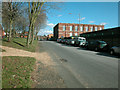
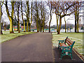
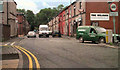
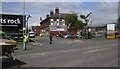
55 photos from this area
Area Information
Key information about the BL9 6EP including its size, population, and administrative classification.
- Area Type
- Postcode
- Area Size
- 3985 m²
- Population
- 1776
- Population Density
- 1174 people/km²
House Prices in BL9 6EP
14
Properties
£257,000
Average Sold Price
£57,995
Lowest Price
£365,000
Highest Price
Showing 14 properties
| Address | Type | Beds | Baths | Last Sale Price | Last Sale Date | |
|---|---|---|---|---|---|---|
| 156 Chesham Road, Bury, BL9 6EP | Terraced | 6 | 2 | £365,000 | Apr 2024 | |
| 164 Chesham Road, Bury, BL9 6EP | Terraced | 4 | 1 | £320,000 | Dec 2023 | |
| 162 Chesham Road, Bury, BL9 6EP | Retail | 5 | 2 | £307,500 | Jul 2022 | |
| 148 Chesham Road, Bury, BL9 6EP | house | 4 | 1 | £335,000 | Apr 2022 | |
| 154 Chesham Road, Bury, BL9 6EP | Terraced | 4 | 1 | £280,000 | Nov 2020 | |
| 152 Chesham Road, Bury, BL9 6EP | house | 1 | 2 | £255,000 | Oct 2015 | |
| 172 Chesham Road, Bury, BL9 6EP | Terraced | 5 | 2 | £262,500 | Apr 2014 | |
| 170 Chesham Road, Bury, BL9 6EP | Terraced | - | - | £215,000 | Jun 2009 | |
| 160 Chesham Road, Bury, BL9 6EP | house | - | - | £183,000 | May 2009 | |
| 158 Chesham Road, Bury, BL9 6EP | Terraced | - | - | £246,000 | Sep 2007 |
Page 1 of 2
Energy Efficiency in BL9 6EP
Amenities
Schools
| Rank | School | Type | Entry gender | Ages |
|---|
Explore more schools in this area
Go to Schools tabDemographics
Household Size
One person
most common
Accommodation Type
Houses
most common
Tenure
52
majority
Ethnic Group
White
most common
Religion
N/A
most common
Household Composition
N/A
most common
Age
47
median
Adults (30-64 years)
most common
Household Deprivation
N/A
with no deprivation
NS-SEC
21
in Lower managerial occupations
Explore more demographic insights in this area
Go to Demographics tabPlanning
Planning Constraints
- Flood RiskPremium
- Ramsar Wetland SitesPremium
- Area of Outstanding Natural BeautyPremium
- Protected Nature ReservePremium
- Protected WoodlandPremium