Area Overview for BL9 5PL
Photos of BL9 5PL
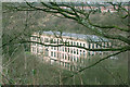
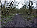
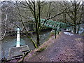
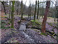
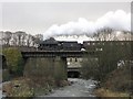
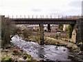
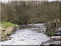

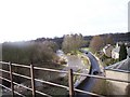
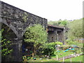
100 photos from this area
Area Information
Key information about the BL9 5PL including its size, population, and administrative classification.
- Area Type
- Postcode
- Area Size
- 2.0 hectares
- Population
- 1497
- Population Density
- 486 people/km²
House Prices in BL9 5PL
27
Properties
£179,611
Average Sold Price
£59,500
Lowest Price
£412,000
Highest Price
Showing 27 properties
| Address | Type | Beds | Baths | Last Sale Price | Last Sale Date | |
|---|---|---|---|---|---|---|
| 16 Hill Street, Ramsbottom, BL9 5PL | Terraced | 2 | 1 | £235,000 | Oct 2025 | |
| 14 Hill Street, Ramsbottom, BL9 5PL | Cottage | 2 | 1 | £212,500 | Oct 2023 | |
| 17 Hill Street, Ramsbottom, BL9 5PL | Terraced | 2 | 1 | £217,500 | Jul 2023 | |
| 13 Hill Street, Ramsbottom, BL9 5PL | Cottage | 2 | 2 | £210,000 | Aug 2022 | |
| River Cottage, 10 Hill Street, Ramsbottom, BL9 5PL | Cottage | 2 | 1 | £220,000 | Jul 2022 | |
| 21 Hill Street, Ramsbottom, BL9 5PL | Cottage | 2 | - | £238,500 | Sep 2021 | |
| 2, Crag House, Hill Street, Ramsbottom, BL9 5PL | house | - | - | £250,000 | Oct 2020 | |
| 20 Hill Street, Ramsbottom, BL9 5PL | house | - | - | £137,500 | Jan 2020 | |
| 9 Hill Street, Ramsbottom, BL9 5PL | Cottage | 4 | 2 | £412,000 | Dec 2019 | |
| 18 Hill Street, Ramsbottom, BL9 5PL | Terraced | 2 | 1 | £145,000 | Jul 2016 |
Page 1 of 3
Energy Efficiency in BL9 5PL
Amenities
Schools
| Rank | School | Type | Entry gender | Ages |
|---|
Explore more schools in this area
Go to Schools tabDemographics
Household Size
Family (3-5 people)
most common
Accommodation Type
Houses
most common
Tenure
86
majority
Ethnic Group
White
most common
Religion
N/A
most common
Household Composition
N/A
most common
Age
47
median
Adults (30-64 years)
most common
Household Deprivation
N/A
with no deprivation
NS-SEC
54
in Lower managerial occupations
Explore more demographic insights in this area
Go to Demographics tabPlanning
Planning Constraints
- Flood RiskPremium
- Ramsar Wetland SitesPremium
- Area of Outstanding Natural BeautyPremium
- Protected Nature ReservePremium
- Protected WoodlandPremium