Area Overview for BL9 5JT
Photos of BL9 5JT
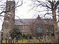
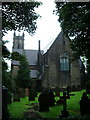
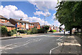
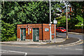
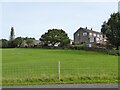
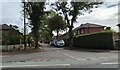
23 photos from this area
Area Information
Key information about the BL9 5JT including its size, population, and administrative classification.
- Area Type
- Postcode
- Area Size
- 1.1 hectares
- Population
- 1488
- Population Density
- 1113 people/km²
House Prices in BL9 5JT
17
Properties
£154,400
Average Sold Price
£40,000
Lowest Price
£310,000
Highest Price
Showing 17 properties
| Address | Type | Beds | Baths | Last Sale Price | Last Sale Date | |
|---|---|---|---|---|---|---|
| 858 Burnley Road, Bury, BL9 5JT | Detached | 3 | 1 | £262,000 | Jan 2025 | |
| 841 Burnley Road, Bury, BL9 5JT | Detached | 4 | 2 | £310,000 | Dec 2024 | |
| 850 Burnley Road, Bury, BL9 5JT | Bungalow | - | - | £165,000 | Nov 2010 | |
| 844 Burnley Road, Bury, BL9 5JT | Bungalow | - | - | £150,000 | Dec 2009 | |
| 849 Burnley Road, Bury, BL9 5JT | Detached | - | - | £249,950 | Dec 2005 | |
| 846 Burnley Road, Bury, BL9 5JT | Detached | - | - | £170,000 | Jan 2005 | |
| 847 Burnley Road, Bury, BL9 5JT | Detached | - | - | £129,000 | Oct 2001 | |
| 856 Burnley Road, Bury, BL9 5JT | Bungalow | 3 | 1 | £83,450 | Dec 1997 | |
| 840 Burnley Road, Bury, BL9 5JT | Bungalow | 3 | 1 | £74,000 | Dec 1997 | |
| 852 Burnley Road, Bury, BL9 5JT | Detached | - | - | £40,000 | Oct 1997 |
Page 1 of 2
Energy Efficiency in BL9 5JT
Amenities
Schools
| Rank | School | Type | Entry gender | Ages |
|---|
Explore more schools in this area
Go to Schools tabDemographics
Household Size
Two person
most common
Accommodation Type
Houses
most common
Tenure
86
majority
Ethnic Group
White
most common
Religion
N/A
most common
Household Composition
N/A
most common
Age
47
median
Adults (30-64 years)
most common
Household Deprivation
N/A
with no deprivation
NS-SEC
41
in Lower managerial occupations
Explore more demographic insights in this area
Go to Demographics tabPlanning
Planning Constraints
- Flood RiskPremium
- Ramsar Wetland SitesPremium
- Area of Outstanding Natural BeautyPremium
- Protected Nature ReservePremium
- Protected WoodlandPremium