Area Overview for BL9 5JA
Photos of BL9 5JA
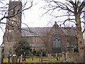
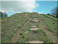
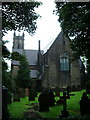
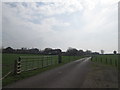
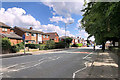
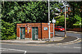
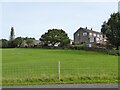
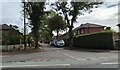
23 photos from this area
Area Information
Key information about the BL9 5JA including its size, population, and administrative classification.
- Area Type
- Postcode
- Area Size
- 1.3 hectares
- Population
- 1472
- Population Density
- 564 people/km²
House Prices in BL9 5JA
18
Properties
£149,500
Average Sold Price
£40,000
Lowest Price
£439,000
Highest Price
Showing 18 properties
| Address | Type | Beds | Baths | Last Sale Price | Last Sale Date | |
|---|---|---|---|---|---|---|
| 601 Walmersley Road, Bury, BL9 5JA | Terraced | 2 | 1 | £114,000 | Dec 2019 | |
| 603 Walmersley Road, Bury, BL9 5JA | Cottage | 2 | 1 | £140,000 | Aug 2019 | |
| 573 Walmersley Road, Bury, BL9 5JA | Detached | 4 | - | £355,000 | Aug 2017 | |
| 577 Walmersley Road, Bury, BL9 5JA | Cottage | 2 | 1 | £112,000 | Jul 2017 | |
| 583 Walmersley Road, Bury, BL9 5JA | house | - | - | £97,000 | Aug 2009 | |
| The Lee, 635 Walmersley Road, Bury, BL9 5JA | Terraced | 2 | 1 | £439,000 | Jun 2006 | |
| 581 Walmersley Road, Bury, BL9 5JA | Cottage | 2 | 1 | £95,000 | Nov 2005 | |
| 579 Walmersley Road, Bury, BL9 5JA | Terraced | - | - | £110,000 | Oct 2005 | |
| 605 Walmersley Road, Bury, BL9 5JA | Cottage | 2 | 1 | £74,500 | Jun 2003 | |
| 587 Walmersley Road, Bury, BL9 5JA | Terraced | - | - | £68,000 | May 2003 |
Page 1 of 2
Energy Efficiency in BL9 5JA
Amenities
Schools
| Rank | School | Type | Entry gender | Ages |
|---|
Explore more schools in this area
Go to Schools tabDemographics
Household Size
Two person
most common
Accommodation Type
Houses
most common
Tenure
76
majority
Ethnic Group
White
most common
Religion
N/A
most common
Household Composition
N/A
most common
Age
47
median
Adults (30-64 years)
most common
Household Deprivation
N/A
with no deprivation
NS-SEC
36
in Lower managerial occupations
Explore more demographic insights in this area
Go to Demographics tabPlanning
Planning Constraints
- Flood RiskPremium
- Ramsar Wetland SitesPremium
- Area of Outstanding Natural BeautyPremium
- Protected Nature ReservePremium
- Protected WoodlandPremium