Area Overview for BL9 0XS
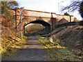
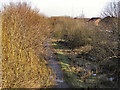
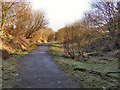
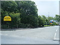
Photos of BL9 0XS
Area Information
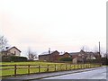
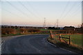
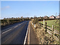
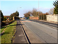
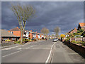
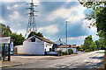
BL9 0XS is a small residential postcode area in England, nestled in the Irwell Valley between Bury and Bolton. With a population of just 1,507, it reflects a tight-knit community where the village of Ainsworth sits on carboniferous sandstone, historically part of Radcliffe parish. The area’s character is shaped by its proximity to both Bury and Bolton, linked by the B6196 road, which has been a key transport route since the early 19th century. Daily life here is grounded in local history, with the Ainsworth Village Conservation Area preserving its linear farming origins and industrial past. Residents benefit from nearby retail hubs like Tesco Radcliffe and Spar Radcliffe, while rail and metro stations offer connections to surrounding towns. The area’s modest size and historical ties to quarrying and cotton industries create a distinct identity, blending rural charm with accessible urban amenities. For buyers, BL9 0XS offers a quiet, low-density living environment with practical transport links, though its small footprint means proximity to larger services is essential.
- Area Type
- Postcode
- Area Size
- Not available
- Population
- 1507
- Population Density
- 6151 people/km²
BL9 0XS is predominantly an owner-occupied area, with 80% of homes privately owned. The housing stock consists mainly of houses, reflecting a traditional, low-density layout typical of smaller rural or semi-rural postcodes. This suggests a focus on family homes and long-term residency, with limited rental activity. The small population and compact size of the area mean the property market is likely niche, with limited inventory and competition. Buyers should consider the proximity to larger towns like Bury and Bolton for broader amenities, as BL9 0XS itself offers minimal retail or leisure options. The high home ownership rate indicates a stable market, but the lack of detailed property price data means potential buyers must assess individual listings carefully. The area’s historical character, including the Ainsworth Conservation Area, may appeal to those seeking heritage or architectural interest.
House Prices in BL9 0XS
No properties found in this postcode.
Energy Efficiency in BL9 0XS
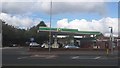
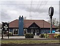
Living in BL9 0XS offers access to essential amenities within practical reach. Retail options include Tesco Radcliffe, Spar Radcliffe, and Tesco Bolton, providing everyday shopping convenience. Transport is well-served by rail and metro stations such as Radcliffe, Bury, and Bury Interchange, ensuring connectivity to surrounding areas. While the area itself has limited leisure facilities, its proximity to the B6196 road and historical sites like the Ainsworth Conservation Area adds character. The village’s preserved farming heritage and industrial history contribute to a distinct local identity. However, residents may need to travel for dining or entertainment, as the postcode lacks dedicated restaurants or cultural venues. The balance of practical amenities and historical context makes BL9 0XS a functional, if modest, base for those prioritising connectivity and quiet living over urban vibrancy.
Amenities
Schools
| Rank | School | Type | Entry gender | Ages |
|---|
Explore more schools in this area
Go to Schools tabDemographics
The population of BL9 0XS is predominantly adults aged 30–64, with a median age of 47. This suggests a mature, stable community, likely with long-term residents and families. Home ownership is high, at 80%, indicating a strong preference for private residence over rental properties. The area’s accommodation is primarily houses, reflecting a traditional, low-density housing stock. The predominant ethnic group is White, which aligns with broader demographic patterns in the region. While specific deprivation data is not provided, the high home ownership rate and age profile suggest a relatively stable economic environment. However, the absence of detailed diversity metrics means the community’s full demographic complexity remains unexplored. The age range implies a mix of professionals, retirees, and families, all contributing to a steady, community-focused lifestyle.
Household Size
Accommodation Type
Tenure
Ethnic Group
Religion
Household Composition
Age
Household Deprivation
NS-SEC
Explore more demographic insights in this area
Go to Demographics tabPlanning
Planning Constraints
- Flood RiskPremium
- Ramsar Wetland SitesPremium
- Area of Outstanding Natural BeautyPremium
- Protected Nature ReservePremium
- Protected WoodlandPremium