Area Overview for BL9 0WA
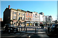
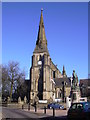
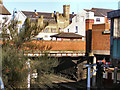
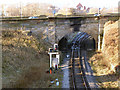
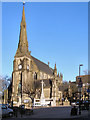
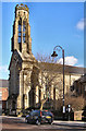
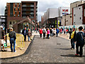
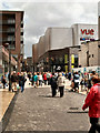
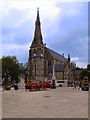
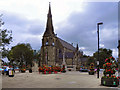
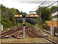
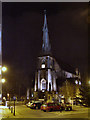
Photos of BL9 0WA
Area Information
BL9 0WA is a small residential postcode area in England, nestled within the broader Redvales district of Bury, Greater Manchester. With a population of just 1,862, it reflects the compact, suburban character typical of post-industrial Lancashire towns. The area lies to the south of Bury town centre, bordered by Manchester Road, the River Irwell, and thoroughfares like Radcliffe Road and Tarn Drive. Historically, Redvales was home to Bury’s first workhouse, built in 1775, and later hosted the Bury Golf Club until 1918. Today, the district is defined by semi-detached housing and traditional mill cottages, offering a quiet, residential lifestyle. Its proximity to the Irwell and the presence of nearby transport hubs make it accessible yet distinct. For those seeking a low-key, community-oriented environment, BL9 0WA provides a blend of historical legacy and modern practicality, though its small size means residents are closely connected to the wider Bury area.
- Area Type
- Postcode
- Area Size
- Not available
- Population
- 1862
- Population Density
- 2710 people/km²
BL9 0WA is primarily an owner-occupied area, with 58% of properties owned by residents. The accommodation type is predominantly houses, which contrasts with areas dominated by flats or rental stock. This suggests a market skewed towards family homes and long-term residency rather than transient tenants. The semi-detached housing and traditional mill cottages in the area reflect a mix of post-industrial and suburban architecture, offering a range of styles for buyers. However, the small size of the postcode means the housing stock is limited, and opportunities for purchase may be constrained to the immediate vicinity. For buyers, this implies a stable but niche market, where properties are likely to be held for the long term. The lack of high-density housing also means the area is unlikely to attract large-scale development, preserving its residential character.
House Prices in BL9 0WA
No properties found in this postcode.
Energy Efficiency in BL9 0WA
Residents of BL9 0WA enjoy a range of amenities within practical reach. The area is served by five metro stops, including Bury Interchange and Bury Bolton Street, providing easy access to shopping, transport, and leisure. Retail options include Heron Bury, Morrisons Daily, and Asda Bury, offering convenience for daily errands. Rail stations like Kearsley and Clifton further enhance connectivity. While the data does not mention parks or recreational spaces, the semi-detached housing and proximity to the River Irwell suggest a quiet, residential lifestyle. The mix of retail, transport, and historical character in the area contributes to a balanced daily life, blending practicality with the low-key charm of a small postcode.
Amenities
Schools
Residents of BL9 0WA have access to a range of educational institutions, including independent schools and sixth-form colleges. Bury Catholic Preparatory School and Bury Grammar Schools cater to younger students, offering independent education with a focus on academic and pastoral care. For secondary education, Bury Grammar School Girls and Bury College provide sixth-form options, while Holy Cross College offers further education and vocational training. The presence of multiple independent schools suggests a strong emphasis on private education, though no Ofsted ratings are available to assess their performance. Families seeking a mix of school types—ranging from primary to higher education—will find BL9 0WA well-served, though the independent focus may limit options for those preferring state-run institutions.
| Rank | School | Type | Entry gender | Ages |
|---|
Explore more schools in this area
Go to Schools tabDemographics
The population of BL9 0WA is 1,862, with a median age of 47, indicating a mature demographic. The majority of residents fall within the 30–64 age range, suggesting a stable community of adults in their prime working and family years. Home ownership is strong, with 58% of properties owned by residents, compared to 42% rented. The area is predominantly composed of houses, reflecting a preference for detached or semi-detached living. The predominant ethnic group is White, aligning with broader trends in the region. While no specific deprivation data is available, the age profile and ownership rates suggest a relatively stable, middle-income community. The absence of significant diversity data means the area’s cultural makeup remains less defined, but its demographic consistency may appeal to those seeking a predictable, low-turnover environment.
Household Size
Accommodation Type
Tenure
Ethnic Group
Religion
Household Composition
Age
Household Deprivation
NS-SEC
Explore more demographic insights in this area
Go to Demographics tabPlanning
Planning Constraints
- Flood RiskPremium
- Ramsar Wetland SitesPremium
- Area of Outstanding Natural BeautyPremium
- Protected Nature ReservePremium
- Protected WoodlandPremium