Area Overview for BL9 0TY
Photos of BL9 0TY
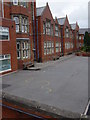
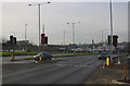
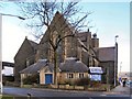
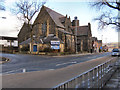

100 photos from this area
Area Information
Key information about the BL9 0TY including its size, population, and administrative classification.
- Area Type
- Postcode
- Area Size
- 5.3 hectares
- Population
- 1697
- Population Density
- 1985 people/km²
House Prices in BL9 0TY
34
Properties
£106,393
Average Sold Price
£61,950
Lowest Price
£220,000
Highest Price
Showing 34 properties
| Address | Type | Beds | Baths | Last Sale Price | Last Sale Date | |
|---|---|---|---|---|---|---|
| 47 Baron Street, Bury, BL9 0TY | Flat | 2 | 1 | £125,000 | Sep 2025 | |
| 10 Baron Street, Bury, BL9 0TY | Terraced | 3 | 1 | £220,000 | Oct 2024 | |
| 35 Baron Street, Bury, BL9 0TY | Flat | - | - | £125,000 | Apr 2024 | |
| 9 Baron Street, Bury, BL9 0TY | Terraced | 3 | 1 | £183,000 | Dec 2023 | |
| 17 Baron Street, Bury, BL9 0TY | Terraced | 3 | 1 | £182,500 | Oct 2023 | |
| 31 Baron Street, Bury, BL9 0TY | Flat | - | - | £133,000 | May 2023 | |
| 4 Baron Street, Bury, BL9 0TY | Terraced | 2 | 2 | £157,950 | Dec 2020 | |
| 8 Baron Street, Bury, BL9 0TY | Terraced | 2 | 1 | £120,000 | Mar 2020 | |
| 15 Baron Street, Bury, BL9 0TY | Terraced | 3 | 1 | £138,650 | Aug 2019 | |
| 43 Baron Street, Bury, BL9 0TY | Flat | 2 | 1 | £94,000 | Nov 2018 |
Page 1 of 4
Energy Efficiency in BL9 0TY
Amenities
Schools
| Rank | School | Type | Entry gender | Ages |
|---|
Explore more schools in this area
Go to Schools tabDemographics
Household Size
Two person
most common
Accommodation Type
Houses
most common
Tenure
71
majority
Ethnic Group
White
most common
Religion
N/A
most common
Household Composition
N/A
most common
Age
47
median
Adults (30-64 years)
most common
Household Deprivation
N/A
with no deprivation
NS-SEC
29
in Lower managerial occupations
Explore more demographic insights in this area
Go to Demographics tabPlanning
Planning Constraints
- Flood RiskPremium
- Ramsar Wetland SitesPremium
- Area of Outstanding Natural BeautyPremium
- Protected Nature ReservePremium
- Protected WoodlandPremium