Area Overview for BL9 0RR
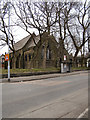
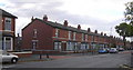
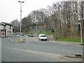
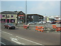
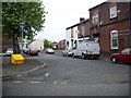
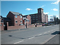
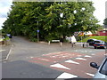
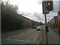
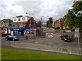
Photos of BL9 0RR


Area Information
Living in BL9 0RR means inhabiting a small, tightly knit residential cluster in the Metropolitan Borough of Bury, Greater Manchester. With a population of 2,649, this area is compact yet steeped in history, situated near Ramsbottom and historically linked to Bury’s ancient settlement origins. The postcode lies along the River Irwell, a location that once supported Saxon and Roman activity. Daily life here is shaped by its proximity to Bury’s rail network, retail hubs, and primary schools. The area’s character is defined by its mix of traditional housing and modern amenities, with a community that reflects its predominantly Asian demographic. While the population is relatively small, the area’s strategic position near Bury Interchange and railway stations ensures connectivity to nearby towns. For those seeking a balance between quiet living and access to urban services, BL9 0RR offers a distinct blend of historical roots and contemporary convenience.
- Area Type
- Postcode
- Area Size
- Not available
- Population
- Not available
- Population Density
- Not available
The property market in BL9 0RR is characterised by a 29% home ownership rate, suggesting that the majority of residents rent their homes. This aligns with a rental market that may offer more flexibility for buyers seeking long-term investment. The accommodation type is primarily houses, which are more common than flats in this area. This housing stock may appeal to families or those preferring larger living spaces. However, the small size of the postcode area means that the housing stock is limited, potentially leading to competition for available properties. Buyers should consider the proximity to amenities such as schools and transport links, which are critical for families. The predominance of houses may also influence property prices, with demand likely driven by the area’s connectivity and historical significance.
House Prices in BL9 0RR
No properties found in this postcode.
Energy Efficiency in BL9 0RR
The lifestyle in BL9 0RR is supported by a range of nearby amenities, including five retail outlets such as Asda Bury, Iceland Bury, and Heron Bury, which cater to daily shopping needs. The area’s proximity to Bury Interchange and railway stations like Kearsley and Clifton ensures convenient access to public transport, facilitating travel to surrounding areas. While the data does not specify leisure or recreational facilities, the historical sites in Bury, such as Peel Tower and Bury Castle, may offer cultural and heritage experiences. The mix of retail, transport, and historical landmarks contributes to a balanced lifestyle, blending practicality with local character. For residents, this means a community that supports both everyday necessities and opportunities for exploration.
Amenities
Schools
BL9 0RR is served by several primary schools, including St Thomas Church of England Primary School, Holy Trinity Primary School, and St Marie’s Roman Catholic Primary School, Bury. Ofsted ratings for three of these schools are marked as 'good', indicating a reliable standard of education. The presence of multiple primary schools suggests a strong focus on early education, which is beneficial for families with young children. However, the data does not include secondary schools, so parents seeking comprehensive schooling may need to look beyond the immediate area. The concentration of primary schools also implies that the community prioritises accessible education for younger students, though further research would be needed to assess the full range of educational opportunities available.
| Rank | School | Type | Entry gender | Ages |
|---|
Explore more schools in this area
Go to Schools tabDemographics
The community in BL9 0RR is predominantly composed of adults aged 30–64, with a median age of 47. This suggests a mature population, likely with established careers and families. Home ownership stands at 29%, indicating a rental market dominates, with many residents living in houses rather than flats. The predominant ethnic group is Asian, reflecting broader demographic trends in the area. This composition influences the local culture and social dynamics, creating a community with shared heritage and traditions. While no specific deprivation data is provided, the low home ownership rate may suggest economic diversity, with a mix of long-term residents and those in rental accommodations. The age profile implies a stable population with a focus on family life, though the absence of data on household types limits further analysis.
Household Size
Accommodation Type
Tenure
Ethnic Group
Religion
Household Composition
Age
Household Deprivation
NS-SEC
Explore more demographic insights in this area
Go to Demographics tabPlanning
Planning Constraints
- Flood RiskPremium
- Ramsar Wetland SitesPremium
- Area of Outstanding Natural BeautyPremium
- Protected Nature ReservePremium
- Protected WoodlandPremium