Area Overview for BL9 0RQ
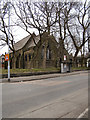
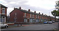
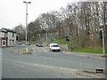
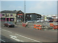
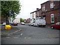
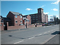
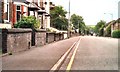
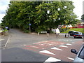
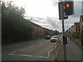
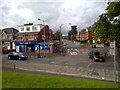
Photos of BL9 0RQ


Area Information
Living in BL9 0RQ places you in a small residential cluster within the Metropolitan Borough of Bury, Greater Manchester. This postcode area, with a population of 2,649, sits near Ramsbottom and is historically linked to Bury’s ancient settlement origins along the River Irwell. The area has roots in Saxon and Roman activity, with landmarks like Peel Tower and Bury Castle reflecting its heritage. Daily life here is shaped by proximity to Bury’s town centre, with access to retail, transport, and community amenities. The area’s mix of historic architecture and modern infrastructure offers a distinct character, blending the charm of listed buildings with contemporary living. Residents benefit from good transport links, including railway stations and metro stops, while the surrounding countryside provides a contrast to urban convenience. BL9 0RQ is ideal for those seeking a balance between residential tranquillity and proximity to services, with a community profile skewed toward adults aged 30–64.
- Area Type
- Postcode
- Area Size
- Not available
- Population
- Not available
- Population Density
- Not available
BL9 0RQ is characterised by a housing stock dominated by houses, with 29% of residents owning their homes. This suggests a rental market that may offer more flexibility for buyers seeking to purchase in a small, defined area. The predominance of houses over flats or apartments could indicate a focus on family-oriented living, though the low home ownership rate implies that many residents are renters. For buyers, this dynamic may mean competition for available properties, particularly in a small postcode area where housing options are limited. The surrounding area’s proximity to Bury’s town centre and transport links may enhance property value potential, but the small size of BL9 0RQ means that immediate surroundings are critical for assessing availability. Prospective buyers should consider the balance between local amenities and the need for broader connectivity.
House Prices in BL9 0RQ
No properties found in this postcode.
Energy Efficiency in BL9 0RQ
BL9 0RQ offers a range of amenities within practical reach, including retail outlets like Asda Bury and Iceland Bury, which cater to everyday needs. The area’s proximity to Bury’s town centre and transport hubs ensures easy access to dining, leisure, and cultural activities. Nearby landmarks such as Peel Tower and Bury Castle provide historical interest, while the surrounding countryside offers opportunities for outdoor recreation. The presence of multiple schools and community facilities suggests a focus on family life, though the absence of specific parks or leisure centres in the data means residents may need to travel slightly further for recreational activities. The mix of retail, transport, and heritage sites contributes to a lifestyle that balances convenience with a connection to the area’s past.
Amenities
Schools
BL9 0RQ is served by several primary schools, including St Thomas Church of England Primary School, Holy Trinity Primary School, and St Marie’s Roman Catholic Primary School in Bury, which holds an Ofsted rating of ‘good’. Two instances of St Thomas Church of England Primary School and Holy Trinity Primary School are listed, both with ‘good’ ratings. This concentration of primary schools provides families with multiple educational options, though the absence of secondary schools nearby may require commuting. The presence of multiple schools with positive Ofsted ratings suggests a focus on quality education, which is a key consideration for families. However, the lack of specific data on school capacity or pupil numbers means that prospective residents should investigate further to ensure alignment with their children’s needs.
| Rank | School | Type | Entry gender | Ages |
|---|
Explore more schools in this area
Go to Schools tabDemographics
The population of BL9 0RQ is 2,649, with a median age of 47 and the majority of residents aged 30–64. This suggests a mature, stable community with a focus on established households. Home ownership rates are low at 29%, indicating that most residents rent their homes, likely due to the area’s housing stock composition. The predominant accommodation type is houses, which may reflect a preference for family homes or larger properties. The predominant ethnic group is Asian, which shapes the cultural and social dynamics of the area. While specific deprivation data is not provided, the low home ownership rate may imply economic diversity or reliance on rental markets. The age profile suggests a community with strong ties to local institutions, such as schools and places of worship, and a potential demand for services catering to middle-aged residents.
Household Size
Accommodation Type
Tenure
Ethnic Group
Religion
Household Composition
Age
Household Deprivation
NS-SEC
Explore more demographic insights in this area
Go to Demographics tabPlanning
Planning Constraints
- Flood RiskPremium
- Ramsar Wetland SitesPremium
- Area of Outstanding Natural BeautyPremium
- Protected Nature ReservePremium
- Protected WoodlandPremium