Area Overview for BL9 0NL
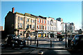
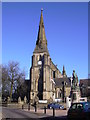
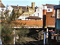
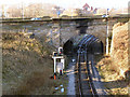
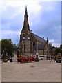
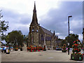
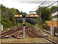
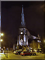
Photos of BL9 0NL
Area Information
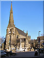
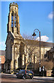
Living in BL9 0NL means inhabiting a compact residential cluster in the Metropolitan Borough of Bury, Greater Manchester. The area covers 6,061 square metres and is home to 1,862 people, making it one of the most densely populated regions in England, with 307,216 people per square kilometre. Historically linked to Bury’s ancient settlement and the River Irwell, this postcode lies near Ramsbottom, within the East Lancashire Railway area. The community benefits from proximity to Bury’s rich heritage, including landmarks like Peel Tower and Bury Castle, though modern infrastructure is limited to nearby retail and transport hubs. Daily life here is shaped by the area’s small scale, with residents navigating a tight-knit environment where local amenities and transport links are key. The high population density suggests a focus on compact living, though the absence of major green spaces or leisure facilities may influence lifestyle choices. For those prioritising proximity to urban services, BL9 0NL offers a mix of historical context and practical connectivity, albeit with challenges in spatial constraints.
- Area Type
- Postcode
- Area Size
- 6061 m²
- Population
- 1862
- Population Density
- 2710 people/km²
BL9 0NL is characterised by a 58% home ownership rate, with houses forming the dominant accommodation type. This suggests a market skewed towards owner-occupied properties rather than rentals, though the exact proportion of rental homes is unspecified. The small area size and high population density indicate a compact housing stock, likely centred on semi-detached or terraced homes typical of historic Bury. For buyers, this means a limited inventory of properties, with potential competition for available homes. The focus on houses rather than flats or apartments may appeal to families seeking space, but the area’s small footprint could restrict options. Proximity to transport links and schools may enhance desirability, though the high crime risk and lack of green spaces could deter some buyers. Those considering the area should weigh the benefits of established housing against the constraints of density and limited amenities.
House Prices in BL9 0NL
Showing 17 properties
Energy Efficiency in BL9 0NL
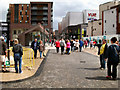
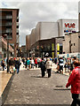
The lifestyle in BL9 0NL is shaped by its proximity to retail and transport hubs, with venues like Tesco Bury, Aldi Tottington, and Heron Bury offering everyday shopping needs. The metro system, including Bury Bolton Street and Bury Interchange, provides access to broader urban networks, while rail stations such as Hall i’ th’ Wood and Kearsley connect to regional routes. However, the area lacks detailed data on parks, leisure facilities, or dining options, suggesting limited recreational amenities. The historical context of Bury, with landmarks like Peel Tower and Bury Castle, may offer cultural interest, but practical daily life appears focused on utilitarian services. The compact nature of the area means residents must rely on nearby towns for more extensive leisure or dining options. Overall, the lifestyle here is functional, prioritising accessibility over expansive amenities, with a strong emphasis on transport and retail connectivity.
Amenities
Schools
Residents of BL9 0NL have access to a range of educational institutions, including independent schools and sixth-form colleges. Nearby options include Bury Catholic Preparatory School and Bury Grammar Schools, both independent, catering to primary and secondary education. For older students, Bury College and Holy Cross College provide sixth-form education, though their Ofsted ratings are not specified. The mix of independent and further education institutions suggests a focus on private schooling, which may appeal to families prioritising specific curricula or facilities. However, the absence of state schools or primary schools in the data means the full spectrum of educational choices remains unclear. For families relying on state education, additional research into nearby areas may be necessary, as the immediate vicinity appears to offer limited public schooling options.
| Rank | School | Type | Entry gender | Ages |
|---|
Explore more schools in this area
Go to Schools tabDemographics
The population of BL9 0NL is predominantly adults aged 30–64, with a median age of 47, reflecting a mature community. Home ownership stands at 58%, with houses being the primary accommodation type, indicating a stable, family-oriented demographic. The predominant ethnic group is White, though no specific data on diversity or deprivation is provided. This suggests a relatively homogeneous population, potentially with established roots in the area. The high proportion of homeownership implies long-term residency, while the absence of rental data means the extent of transient populations is unclear. The age profile indicates a community with a strong presence of middle-aged individuals, possibly retired or in later careers, which may influence local services and amenities. The lack of specific data on deprivation or income levels means the area’s socioeconomic challenges remain unquantified, though the high population density could correlate with limited space for expansion or development.
Household Size
Accommodation Type
Tenure
Ethnic Group
Religion
Household Composition
Age
Household Deprivation
NS-SEC
Explore more demographic insights in this area
Go to Demographics tabPlanning
Planning Constraints
- Flood RiskPremium
- Ramsar Wetland SitesPremium
- Area of Outstanding Natural BeautyPremium
- Protected Nature ReservePremium
- Protected WoodlandPremium