Area Overview for BL9 0HN
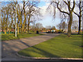
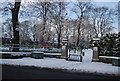
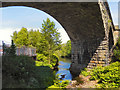
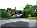
Photos of BL9 0HN
Area Information
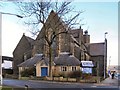
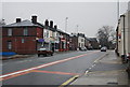
BL9 0HN is a small residential postcode area in England, encompassing a tightly packed cluster of homes within the Redvales district of Bury, Greater Manchester. The area spans just 2.9 hectares, yet it is densely populated, with 1,697 residents living at a density of 58,277 people per square kilometre. This compact footprint reflects its suburban character, typical of post-industrial Lancashire towns. Historically, the area was shaped by Bury’s 18th-century workhouse and later by the Bury Golf Club, which operated until wartime demands shifted its use. Today, Redvales is defined by semi-detached housing and traditional mill cottages near the River Irwell. The community is mature, with a median age of 47, and predominantly composed of adults aged 30–64. Living here offers proximity to Bury’s town centre, with easy access to rail, metro, and retail hubs, though the small size of the area means the local environment is tightly knit, with limited expansion potential.
- Area Type
- Postcode
- Area Size
- 2.9 hectares
- Population
- 1697
- Population Density
- 1985 people/km²
BL9 0HN is predominantly an owner-occupied area, with 71% of homes owned by residents rather than rented. The accommodation type is exclusively houses, with no flats or apartments listed in the data. This suggests a housing stock characterised by semi-detached properties and traditional mill cottages, reflecting the suburban, post-industrial character of Redvales. The small area size and high population density indicate limited availability of new housing, which could make the local market competitive for buyers. For those seeking homes in BL9 0HN, the focus is on existing properties, with little scope for new developments. The high home ownership rate also suggests a stable market, though buyers should consider the area’s compact nature and proximity to Bury’s town centre when evaluating long-term value.
House Prices in BL9 0HN
Showing 2 properties
| Address | Type | Beds | Baths | Last Sale Price | Last Sale Date | |
|---|---|---|---|---|---|---|
| 31 Walshe Street, Bury, BL9 0HN | Industrial | - | - | - | - | |
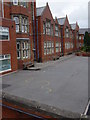
| Bury Grammar Boys School, Tenterden Street, Bury, BL9 0HN | commercial | - | - | - | - |
Energy Efficiency in BL9 0HN
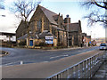
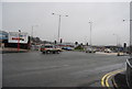
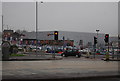
The lifestyle in BL9 0HN is shaped by its proximity to Bury’s town centre and surrounding amenities. Within practical reach are retail outlets such as Lidl Seddons, Heron Bury, and Aldi Tottington, offering everyday shopping convenience. The area’s metro and rail links, including Bury Bolton Street and Bury Interchange, provide easy access to public transport. While specific parks or leisure facilities are not named in the data, the historical presence of the Bury Golf Club and the area’s proximity to the River Irwell suggest opportunities for outdoor activities. The compact nature of BL9 0HN means amenities are concentrated, fostering a convenient, if limited, lifestyle. Residents can enjoy a mix of suburban tranquillity and urban accessibility, with the character of semi-detached housing and traditional mill cottages adding to the area’s distinct identity.
Amenities
Schools
Residents of BL9 0HN have access to several primary schools, including The Derby High School, Bury Church of England High School, and St Gabriel’s RC High School. Two of these are academies: St Gabriel’s RC High School, a Voluntary Academy with a ‘good’ Ofsted rating, and Bury Church of England High School, which has a ‘satisfactory’ rating. The presence of both traditional state schools and academies offers families a range of educational options, though the ratings suggest variability in performance. For parents prioritising high standards, St Gabriel’s RC High School’s ‘good’ rating may be a key consideration. The proximity of these schools to the area makes BL9 0HN an attractive option for families seeking primary education within walking distance.
| Rank | School | Type | Entry gender | Ages |
|---|
Explore more schools in this area
Go to Schools tabDemographics
The population of BL9 0HN is 1,697, with a median age of 47, indicating a community skewed toward middle-aged adults. The most common age range is 30–64 years, suggesting a stable demographic with established households. Home ownership is high at 71%, reflecting a strong presence of owner-occupied properties. The area is dominated by houses, with no mention of flats or apartments in the data. The predominant ethnic group is White, though no further breakdown of diversity is provided. The high home ownership rate and mature age profile imply a settled community with long-term residency. However, the lack of specific data on deprivation or income levels means the quality of life for residents cannot be fully contextualised beyond the given figures.
Household Size
Accommodation Type
Tenure
Ethnic Group
Religion
Household Composition
Age
Household Deprivation
NS-SEC
Explore more demographic insights in this area
Go to Demographics tabPlanning
Planning Constraints
- Flood RiskPremium
- Ramsar Wetland SitesPremium
- Area of Outstanding Natural BeautyPremium
- Protected Nature ReservePremium
- Protected WoodlandPremium