Area Overview for BL8 4LA
Photos of BL8 4LA
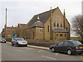
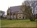
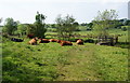
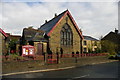
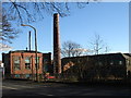
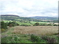
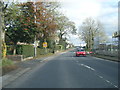
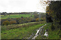
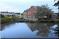
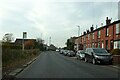

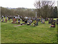
36 photos from this area
Area Information
Key information about the BL8 4LA including its size, population, and administrative classification.
- Area Type
- Postcode
- Area Size
- 22.3 hectares
- Population
- 1477
- Population Density
- 225 people/km²
House Prices in BL8 4LA
8
Properties
£357,855
Average Sold Price
£165,000
Lowest Price
£500,000
Highest Price
Showing 8 properties
| Address | Type | Beds | Baths | Last Sale Price | Last Sale Date | |
|---|---|---|---|---|---|---|
| Top O Th Brow, Two Brooks Lane, Tottington, BL8 4LA | house | 5 | 2 | £500,000 | Jul 2014 | |
| 3 Two Brooks Lane, Tottington, BL8 4LA | Terraced | - | - | £350,000 | Oct 2006 | |
| 1 Two Brooks Lane, Tottington, BL8 4LA | Terraced | - | - | £416,420 | Mar 2006 | |
| 6 Two Brooks Lane, Tottington, BL8 4LA | Semi-detached | 5 | 2 | £165,000 | Aug 2000 | |
| Tennis 140M From 15 Mandeville Terrace 10M From Unnamed Road, Footpath From Two Brooks Lane North East To Bolton Road, Tottington, BL8 4LA | Leisure | - | - | - | - | |
| Tennis 207M From St Marys Church, Bolton Road 29M From Unnamed Road, Two Brooks Lane, Tottington, BL8 4LA | Leisure | - | - | - | - | |
| Tennis 169M From 15 Mandeville Terrace 25M From Unnamed Road, Footpath From Two Brooks Lane North East To Bolton Road, Tottington, BL8 4LA | Leisure | - | - | - | - | |
| Turton House, 5 Two Brooks Lane, Tottington, BL8 4LA | house | - | - | - | - |
Energy Efficiency in BL8 4LA
Amenities
Schools
| Rank | School | Type | Entry gender | Ages |
|---|
Explore more schools in this area
Go to Schools tabDemographics
Household Size
Two person
most common
Accommodation Type
Houses
most common
Tenure
91
majority
Ethnic Group
White
most common
Religion
N/A
most common
Household Composition
N/A
most common
Age
47
median
Adults (30-64 years)
most common
Household Deprivation
N/A
with no deprivation
NS-SEC
47
in Lower managerial occupations
Explore more demographic insights in this area
Go to Demographics tabPlanning
Planning Constraints
- Flood RiskPremium
- Ramsar Wetland SitesPremium
- Area of Outstanding Natural BeautyPremium
- Protected Nature ReservePremium
- Protected WoodlandPremium