Area Overview for BL8 3DH
Photos of BL8 3DH
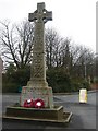
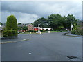
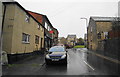
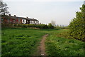
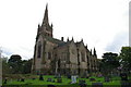
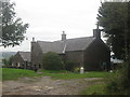
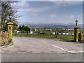
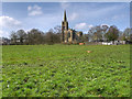
68 photos from this area
Area Information
Key information about the BL8 3DH including its size, population, and administrative classification.
- Area Type
- Postcode
- Area Size
- 17.5 hectares
- Population
- 1488
- Population Density
- 1090 people/km²
House Prices in BL8 3DH
43
Properties
£278,303
Average Sold Price
£1,215
Lowest Price
£620,000
Highest Price
Showing 43 properties
| Address | Type | Beds | Baths | Last Sale Price | Last Sale Date | |
|---|---|---|---|---|---|---|
| 14 Gisburn Drive, Bury, BL8 3DH | Bungalow | 3 | 1 | £305,000 | Mar 2025 | |
| 32 Gisburn Drive, Bury, BL8 3DH | Detached | 4 | 2 | £485,500 | Apr 2023 | |
| 3 Gisburn Drive, Bury, BL8 3DH | Detached | 4 | - | £371,500 | Jul 2021 | |
| 31 Gisburn Drive, Bury, BL8 3DH | house | - | - | £620,000 | Jun 2021 | |
| 17 Gisburn Drive, Bury, BL8 3DH | Detached | 4 | 1 | £1,595 | May 2020 | |
| 16 Gisburn Drive, Bury, BL8 3DH | Bungalow | 4 | 2 | £350,000 | Feb 2020 | |
| 33 Gisburn Drive, Bury, BL8 3DH | Detached | - | - | £1,215 | Mar 2018 | |
| 45 Gisburn Drive, Bury, BL8 3DH | Bungalow | 4 | 2 | £450,000 | Oct 2017 | |
| 41 Gisburn Drive, Bury, BL8 3DH | Bungalow | - | - | £290,000 | May 2015 | |
| 38 Gisburn Drive, Bury, BL8 3DH | Detached | 6 | 4 | £325,000 | Feb 2014 |
Page 1 of 5
Energy Efficiency in BL8 3DH
Amenities
Schools
| Rank | School | Type | Entry gender | Ages |
|---|
Explore more schools in this area
Go to Schools tabDemographics
Household Size
Two person
most common
Accommodation Type
Houses
most common
Tenure
88
majority
Ethnic Group
White
most common
Religion
N/A
most common
Household Composition
N/A
most common
Age
47
median
Adults (30-64 years)
most common
Household Deprivation
N/A
with no deprivation
NS-SEC
45
in Lower managerial occupations
Explore more demographic insights in this area
Go to Demographics tabPlanning
Planning Constraints
- Flood RiskPremium
- Ramsar Wetland SitesPremium
- Area of Outstanding Natural BeautyPremium
- Protected Nature ReservePremium
- Protected WoodlandPremium