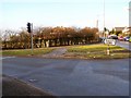
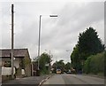
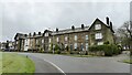
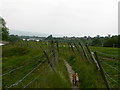
Area Overview for BL8 2WZ
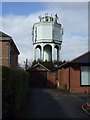
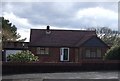
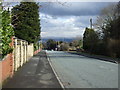
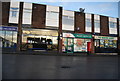
Photos of BL8 2WZ
Area Information
BL8 2WZ is a small residential postcode area within the Metropolitan Borough of Bury, Greater Manchester. With a population of 1,488 and a density of 1,090 people per square kilometre, it reflects a compact, tightly knit community. Situated near the town centre of Bury, the area is part of the Bury West electoral ward, which recorded a 2021 census population of 10,950. Daily life here is shaped by its proximity to urban amenities while retaining a residential character. The area’s median age of 47 suggests a mature population, with adults aged 30–64 forming the largest demographic group. This cluster of homes, predominantly owner-occupied, offers a stable environment for families and individuals seeking a settled lifestyle. The postcode’s small size means residents are likely to know their neighbours, with local shops, transport links, and schools within easy reach. Its location in Greater Manchester ensures access to larger city amenities without the density of urban centres. For those considering a home in BL8 2WZ, the balance of community feel and practicality is a key draw.
- Area Type
- Postcode
- Area Size
- Not available
- Population
- 1488
- Population Density
- 1090 people/km²
The property market in BL8 2WZ is characterised by high home ownership, with 88% of residents owning their homes. This suggests a strong sense of community and long-term residency, typical of areas with established housing stock. The accommodation type is predominantly houses, which are likely to be semi-detached or terraced properties given the area’s small size and residential density. This contrasts with areas dominated by flats or rental properties, making BL8 2WZ a more family-friendly option. The high ownership rate implies limited rental availability, which could be a consideration for buyers seeking investment opportunities or those prioritising long-term stability. For prospective buyers, the focus on owner-occupied housing means the market is less speculative, with properties likely to retain value. However, the small size of the area means competition for available homes could be intense, particularly for those seeking specific features or proximity to local amenities.
House Prices in BL8 2WZ
No properties found in this postcode.
Energy Efficiency in BL8 2WZ
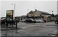
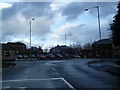
Living in BL8 2WZ offers access to a range of local amenities within easy reach. The area’s retail options include Co-op Mile, Spar Radcliffe, and Morrisons Daily Bury 131, providing essential shopping and grocery needs. For transport, residents have five metro stations, including Bury Bolton Street and Bury Interchange, as well as five rail stations such as Hall i’ th’ Wood Railway Station, which connect to broader regional networks. These links facilitate commuting to Manchester or other nearby towns. The presence of multiple stations also supports a lifestyle that balances local convenience with urban accessibility. While the data does not specify parks or leisure facilities, the proximity to Bury’s town centre suggests opportunities for dining, entertainment, and cultural activities. The area’s compact size ensures that daily errands and social needs can be met without long journeys, enhancing its appeal as a practical and connected community.
Amenities
Schools
The nearest school to BL8 2WZ is Lowercroft Primary School, a primary institution with an Ofsted rating of “good”. This provides families with a locally accessible education option for younger children, reducing the need for long commutes. The absence of secondary schools in the immediate vicinity means parents may need to consider nearby towns or districts for secondary education. The presence of a well-rated primary school is a key factor for families prioritising school quality, though the lack of secondary options could influence decisions about where to live. The school’s rating suggests a standard of education that meets or exceeds average expectations, offering reassurance for those seeking reliable local provision. For residents, the proximity of Lowercroft Primary School enhances the area’s appeal as a family-friendly location.
| Rank | School | Type | Entry gender | Ages |
|---|
Explore more schools in this area
Go to Schools tabDemographics
The population of BL8 2WZ has a median age of 47, with the largest age group being adults aged 30–64. This suggests a community of established residents, many of whom may be in their prime working years or nearing retirement. Home ownership is high at 88%, indicating a stable housing market with long-term residents. The accommodation type is predominantly houses, which aligns with the area’s residential character and likely contributes to a sense of privacy and space. The predominant ethnic group is White, reflecting broader demographic trends in the region. While specific data on deprivation is not provided, the high home ownership rate and mature age profile suggest a relatively stable socioeconomic environment. However, the absence of detailed deprivation metrics means the full picture of quality of life remains partially obscured. The area’s demographic profile paints a picture of a settled, family-oriented community with strong ties to local institutions and services.
Household Size
Accommodation Type
Tenure
Ethnic Group
Religion
Household Composition
Age
Household Deprivation
NS-SEC
Explore more demographic insights in this area
Go to Demographics tabPlanning
Planning Constraints
- Flood RiskPremium
- Ramsar Wetland SitesPremium
- Area of Outstanding Natural BeautyPremium
- Protected Nature ReservePremium
- Protected WoodlandPremium