Area Overview for BL8 2WT
Photos of BL8 2WT


Area Information
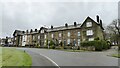
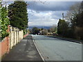
BL8 2WT is a small residential postcode area in the heart of Bury, Greater Manchester, part of the Bury West electoral ward. With a population of 1,488 and a density of 1,090 people per square kilometre, it reflects a compact, tightly knit community. Situated near the town centre of Bury, the area benefits from proximity to local services, transport hubs, and retail. The median age of 47 suggests a mature demographic, with the majority of residents aged 30–64. This is a predominantly owner-occupied area, with 88% of homes owned by residents, and most properties are houses rather than flats. The area’s character is shaped by its residential focus, offering a quieter, family-oriented environment. Nearby, Lowercroft Primary School provides a good-rated education for younger children, while multiple rail and metro stations offer easy access to Greater Manchester’s broader network. Daily life here balances local convenience with connections to the wider region, making it suitable for those seeking stability and accessibility.
- Area Type
- Postcode
- Area Size
- Not available
- Population
- 1488
- Population Density
- 1090 people/km²
BL8 2WT is a largely owner-occupied area, with 88% of homes owned by residents rather than rented. This high ownership rate suggests a stable market with long-term residents, reducing the likelihood of short-term rental turnover. The accommodation type is predominantly houses, which are typically larger and more suitable for families, aligning with the area’s mature demographic. As a small postcode area, the housing stock is limited, meaning opportunities for buyers may be constrained to specific properties. The focus on owner-occupation indicates a lack of speculative investment or rental demand, which could benefit buyers seeking a place to settle rather than a transient property. However, the limited size of the area means buyers should act quickly, as inventory is unlikely to be extensive.
House Prices in BL8 2WT
No properties found in this postcode.
Energy Efficiency in BL8 2WT
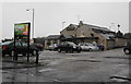
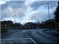
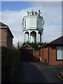
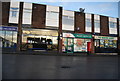
BL8 2WT offers a mix of retail, transport, and leisure options within practical reach. The area’s five retail outlets, including Co-op Mile and Morrisons, provide convenience for everyday shopping, while the presence of five metro and three rail stations ensures easy access to Bury’s town centre and beyond. These transport links are particularly valuable for commuters and those reliant on public transport. The proximity to multiple stations also supports a lifestyle that balances local living with regional connectivity. For leisure, the area’s compact size means residents can quickly access amenities in Bury, though specific parks or recreational facilities are not listed in the data. Overall, the combination of retail, transport, and proximity to Bury’s core creates a functional, accessible lifestyle.
Amenities
Schools
The nearest school to BL8 2WT is Lowercroft Primary School, a primary institution with a ‘good’ Ofsted rating. This provides a solid educational foundation for young families, though no secondary schools are listed in the data. The presence of a well-rated primary school is a key draw for families prioritising early education, but parents seeking secondary schooling may need to look beyond the immediate area. The school’s rating suggests a focus on quality teaching and facilities, which could be a deciding factor for homebuyers. However, the absence of secondary schools highlights a potential gap in the local educational infrastructure, requiring careful consideration for households with older children.
| Rank | School | Type | Entry gender | Ages |
|---|
Explore more schools in this area
Go to Schools tabDemographics
The population of BL8 2WT is 1,488, with a median age of 47, reflecting a community dominated by adults aged 30–64. This age range indicates a mature, established population, likely with long-term residency and family ties. Home ownership is exceptionally high at 88%, suggesting a stable, long-term housing market with minimal rental activity. The area is predominantly composed of houses, not flats, which aligns with the demographic of older, family-oriented residents. The predominant ethnic group is White, though specific data on diversity or deprivation is not provided. The high home ownership rate and age profile imply a community with strong local connections and economic stability. However, the absence of detailed diversity metrics means the full range of cultural or social dynamics remains unexplored.
Household Size
Accommodation Type
Tenure
Ethnic Group
Religion
Household Composition
Age
Household Deprivation
NS-SEC
Explore more demographic insights in this area
Go to Demographics tabPlanning
Planning Constraints
- Flood RiskPremium
- Ramsar Wetland SitesPremium
- Area of Outstanding Natural BeautyPremium
- Protected Nature ReservePremium
- Protected WoodlandPremium