Area Overview for BL8 2FR
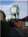
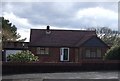
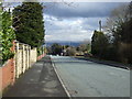
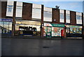
Photos of BL8 2FR
Area Information
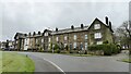
BL8 2FR is a small residential postcode area nestled in the heart of Bury, Greater Manchester. With a population of just 1,336, it reflects the quiet, compact nature of the broader Bury West ward, which sits around coordinates 53.592627, -2.310206. This area is characterised by its proximity to Bury town centre, offering a blend of suburban tranquillity and easy access to urban amenities. The community here is predominantly elderly, with a median age of 47 and a significant proportion of residents aged 65 and over. This demographic suggests a mature, stable population, many of whom likely own their homes, as 94% of properties are owner-occupied. The area’s housing stock is largely composed of houses, contributing to a more traditional, family-oriented feel. While the postcode covers a small cluster of residences, its location within Bury means residents benefit from the town’s established infrastructure, including retail, transport, and local services. For those seeking a peaceful yet connected lifestyle, BL8 2FR offers a snapshot of northern England’s suburban charm, tempered by the realities of a high-crime environment.
- Area Type
- Postcode
- Area Size
- Not available
- Population
- 1336
- Population Density
- 3842 people/km²
The property market in BL8 2FR is overwhelmingly owner-occupied, with 94% of homes owned by residents rather than rented. This high rate of home ownership suggests a community of long-term residents, many of whom may have purchased properties decades ago. The accommodation type is exclusively houses, which contrasts with areas where flats or apartments dominate. This housing stock likely includes semi-detached and detached properties, offering larger living spaces compared to urban centres. Given the small size of the postcode area, the number of available properties is limited, making the market potentially less dynamic for buyers. However, the presence of houses may appeal to those seeking family-friendly homes with garden space. Prospective buyers should consider the area’s proximity to Bury’s amenities, though the small size of BL8 2FR means immediate surroundings are key for additional options.
House Prices in BL8 2FR
No properties found in this postcode.
Energy Efficiency in BL8 2FR
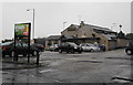
Life in BL8 2FR is shaped by its proximity to a range of amenities that cater to daily needs. Within walking or short driving distance are five retail outlets, including Co-op Mile, Spar Radcliffe, and Tesco Bury, ensuring residents have access to groceries, essentials, and convenience shopping. The area’s transport links are equally strong, with five metro stations and five rail stations nearby, including Bury Bolton Street and Hall i’ th’ Wood, facilitating easy travel to Bury town centre and beyond. While the data does not mention parks or leisure facilities explicitly, the presence of multiple transport and retail hubs suggests a functional, service-oriented lifestyle. The mix of retail, transport, and local services creates a practical environment for those prioritising accessibility over expansive recreational spaces. However, the limited mention of green spaces or cultural amenities means the area’s lifestyle is more utilitarian than leisure-focused.
Amenities
Schools
The nearest school to BL8 2FR is Greenhill Primary School, a primary institution serving the local community. While the data lists the school twice, it appears to be the sole educational facility in the immediate vicinity. The absence of secondary schools or other educational institutions suggests that families may need to look beyond the postcode for comprehensive schooling. For primary education, Greenhill Primary School is the primary option, though no Ofsted rating is provided in the data. The lack of diversity in school types—only a primary school—is notable, as it may limit choices for parents seeking a range of educational provisions. Families with older children would need to explore nearby areas for secondary education, which could impact the area’s appeal for those prioritising a full spectrum of schooling options.
| Rank | School | Type | Entry gender | Ages |
|---|
Explore more schools in this area
Go to Schools tabDemographics
The demographic profile of BL8 2FR is defined by its older population, with a median age of 47 and the most common age range being 65+. This suggests a community with a significant proportion of retired individuals or those nearing retirement, which may influence local services and amenities. Home ownership is exceptionally high at 94%, indicating a strong preference for long-term residency over rental properties. The accommodation type is predominantly houses, which aligns with the area’s traditional, low-density housing stock. The predominant ethnic group is White, reflecting broader trends in the Metropolitan Borough of Bury. While no specific data on deprivation or diversity is provided, the high home ownership rate and age profile imply a relatively stable, low-turnover community. However, the absence of detailed socioeconomic data means the full picture of quality of life remains partially obscured.
Household Size
Accommodation Type
Tenure
Ethnic Group
Religion
Household Composition
Age
Household Deprivation
NS-SEC
Explore more demographic insights in this area
Go to Demographics tabPlanning
Planning Constraints
- Flood RiskPremium
- Ramsar Wetland SitesPremium
- Area of Outstanding Natural BeautyPremium
- Protected Nature ReservePremium
- Protected WoodlandPremium