Area Overview for BL8 2BY
Photos of BL8 2BY


Area Information
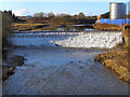
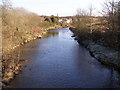
BL8 2BY is a small residential postcode nestled within the town of Bury, Greater Manchester. With a population of 1,871, it forms part of the larger Bury West electoral ward, which had a 2021 census population of 10,950. Located near Bury’s town centre, this area is defined by its compact footprint and proximity to key local services. The median age of 47 suggests a community of established residents, many of whom are in their prime working years. Daily life here is shaped by its position in a historically industrial part of Greater Manchester, with a mix of residential and commercial activity. The area’s small size means it is tightly integrated with surrounding neighbourhoods, offering access to Bury’s broader amenities while maintaining a distinct local character. For those seeking a balance between urban convenience and a quieter residential setting, BL8 2BY provides proximity to transport networks, retail hubs, and schools, all within a short distance. Its location near Bury’s core also means residents benefit from the town’s cultural and economic offerings without the density of larger urban centres.
- Area Type
- Postcode
- Area Size
- Not available
- Population
- 1871
- Population Density
- 1968 people/km²
The property market in BL8 2BY is characterised by a 52% home ownership rate, with houses forming the predominant accommodation type. This suggests a residential area where many properties are owner-occupied rather than rented, though the remaining 48% likely includes a mix of private rentals and social housing. The focus on houses rather than flats or apartments indicates a preference for standalone homes, which may appeal to families or those seeking more space. Given the small size of the postcode, the housing stock is limited, and buyers may need to consider nearby areas for a broader selection. The area’s proximity to Bury’s town centre and transport links adds to its appeal, though the high crime risk reported in assessments could influence property values and desirability. For buyers, this means a compact market with established homes but limited scope for expansion, requiring careful consideration of both location and safety factors.
House Prices in BL8 2BY
No properties found in this postcode.
Energy Efficiency in BL8 2BY
The lifestyle in BL8 2BY is shaped by its proximity to a range of amenities, including five retail outlets such as Tesco Bury and Morrisons Daily, which provide essential shopping options. The area’s transport network, with five metro and five rail stations, ensures easy access to Bury’s town centre and beyond, supporting both daily commutes and leisure travel. While parks and green spaces are not explicitly listed in the data, the absence of protected natural areas or planning constraints suggests potential for local recreational use. The presence of multiple schools and retail hubs indicates a community-oriented environment, though the lack of specific leisure venues means residents may need to travel for cultural or entertainment activities. Overall, the area offers practical convenience for everyday needs, with a focus on connectivity and accessibility.
Amenities
Schools
Residents of BL8 2BY have access to two special schools within practical reach. Forestwood School, rated ‘good’ by Ofsted, provides education for students with specific learning needs, while Mill School – Bury, rated ‘satisfactory’, offers similar provisions for younger pupils. The presence of two special schools suggests the area caters to families with children requiring tailored educational support. However, no mainstream primary or secondary schools are listed in the data, which may require families to travel further for general education. The Ofsted ratings indicate that while one school meets quality standards, the other has room for improvement. For parents prioritising specialist education, this area offers dedicated resources, but those seeking a broader range of schools may need to look beyond the immediate vicinity.
| Rank | School | Type | Entry gender | Ages |
|---|
Explore more schools in this area
Go to Schools tabDemographics
The community in BL8 2BY is predominantly composed of adults aged 30–64, with a median age of 47. This suggests a population largely in their working years, with a strong presence of families and professionals. Home ownership stands at 52%, indicating a mix of owner-occupied properties and rental units. The accommodation type is primarily houses, which is typical for areas with established residential development. The predominant ethnic group is White, though no specific data on diversity or minority representation is provided. The absence of detailed information on deprivation or income levels means it is difficult to assess the area’s economic challenges, but the high home ownership rate and median age suggest a stable, long-term resident base. The age profile implies a community with a focus on family life and career stability, though the lack of younger residents may affect local schools and amenities.
Household Size
Accommodation Type
Tenure
Ethnic Group
Religion
Household Composition
Age
Household Deprivation
NS-SEC
Explore more demographic insights in this area
Go to Demographics tabPlanning
Planning Constraints
- Flood RiskPremium
- Ramsar Wetland SitesPremium
- Area of Outstanding Natural BeautyPremium
- Protected Nature ReservePremium
- Protected WoodlandPremium