Area Overview for BL8 2AY
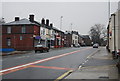
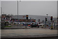
Photos of BL8 2AY


Area Information
Living in BL8 2AY means inhabiting a compact, densely populated residential cluster in the heart of Bury, Greater Manchester. The area covers just 1.3 hectares but is home to 1,871 people, making it one of the most densely populated postcode areas in England, with over 147,000 people per square kilometre. Situated around the coordinates 53.592627, -2.310206, it lies within the Bury West electoral ward, a community with a 2021 census population of 10,950 and an average age of 44.4. This is a place where daily life is shaped by proximity to urban amenities and a well-established town centre. The small area’s character is defined by its mix of residential properties and limited green space, with most residents living in houses rather than flats. While the area’s size is modest, its strategic location near Bury’s core offers access to local services, transport links, and a range of nearby schools. For those seeking a compact, urban setting with direct access to Greater Manchester’s infrastructure, BL8 2AY is a distinct choice.
- Area Type
- Postcode
- Area Size
- 1.3 hectares
- Population
- 1871
- Population Density
- 1968 people/km²
The property market in BL8 2AY is defined by its small size and limited housing stock. With 52% of properties owner-occupied, the area leans towards a mix of long-term residents and renters, though the exact proportion of rental properties is not specified. The accommodation type is predominantly houses, which contrasts with areas where flats or apartments dominate. This suggests a more traditional, family-oriented housing stock, though the compact nature of the postcode means the immediate surroundings are likely to have similar characteristics. For buyers, the limited number of properties available in BL8 2AY itself means the market is likely to be competitive, with many prospective buyers looking to the broader Bury area for options. The high population density and small area size also mean that property values may be influenced by proximity to local amenities and transport links, rather than the size of individual homes.
House Prices in BL8 2AY
No properties found in this postcode.
Energy Efficiency in BL8 2AY
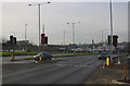
Life in BL8 2AY is shaped by its proximity to a range of amenities that cater to daily needs. Within practical reach are five retail outlets, including major supermarkets like Tesco Bury and Morrisons Daily Bury 131, ensuring access to groceries and everyday essentials. The area’s transport network is extensive, with five metro stops and five rail stations, including Bury Bolton Street and Kearsley Railway Station, providing seamless connections to the wider region. While the area itself is small, its location near Bury’s town centre means residents can access additional leisure, dining, and cultural options beyond the immediate postcode. The availability of multiple transport options and retail choices enhances convenience, allowing residents to manage work, shopping, and social activities efficiently. This accessibility contributes to a lifestyle that balances urban convenience with the practicalities of a compact residential area.
Amenities
Schools
Residents of BL8 2AY have access to two special schools within practical reach: Forestwood School and Mill School – Bury. Forestwood School holds a ‘good’ Ofsted rating, indicating a strong educational provision tailored to specific needs, while Mill School – Bury has a ‘satisfactory’ rating, suggesting it meets basic standards but may have areas for improvement. The presence of two special schools highlights the area’s focus on supporting students with particular educational requirements, though it does not include mainstream schools. Families with children requiring specialist education will find these institutions accessible, but those seeking a broader range of school types may need to look further afield. The mix of school types reflects the community’s priorities and the infrastructure available to serve its demographic profile.
| Rank | School | Type | Entry gender | Ages |
|---|
Explore more schools in this area
Go to Schools tabDemographics
The community in BL8 2AY is predominantly middle-aged, with a median age of 47 and the most common age range being adults aged 30–64. This suggests a population largely focused on established careers and family life. Home ownership rates stand at 52%, indicating a balanced mix of owner-occupied and rental properties. The area is characterised by houses rather than flats, reflecting a traditional residential layout. The predominant ethnic group is White, which aligns with broader demographic trends in the Bury borough. While specific data on deprivation is not provided, the high population density and limited green space may influence quality of life, particularly for those prioritising open space. The age profile suggests a stable, long-term resident base, with fewer young families or retirees compared to other areas. This demographic structure shapes local needs, from school provision to community services, and may influence the character of the neighbourhood.
Household Size
Accommodation Type
Tenure
Ethnic Group
Religion
Household Composition
Age
Household Deprivation
NS-SEC
Explore more demographic insights in this area
Go to Demographics tabPlanning
Planning Constraints
- Flood RiskPremium
- Ramsar Wetland SitesPremium
- Area of Outstanding Natural BeautyPremium
- Protected Nature ReservePremium
- Protected WoodlandPremium