Area Overview for BL8 1LS
Photos of BL8 1LS
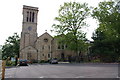
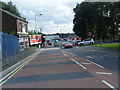
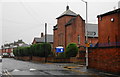
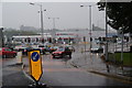
66 photos from this area
Area Information
Key information about the BL8 1LS including its size, population, and administrative classification.
- Area Type
- Postcode
- Area Size
- 4739 m²
- Population
- 1852
- Population Density
- 4627 people/km²
House Prices in BL8 1LS
22
Properties
£127,773
Average Sold Price
£35,000
Lowest Price
£201,000
Highest Price
Showing 22 properties
| Address | Type | Beds | Baths | Last Sale Price | Last Sale Date | |
|---|---|---|---|---|---|---|
| 153 Tottington Road, Bury, BL8 1LS | Terraced | 2 | 1 | £160,000 | Nov 2022 | |
| 155 Tottington Road, Bury, BL8 1LS | house | 2 | 1 | £160,000 | Jul 2022 | |
| 125 Tottington Road, Bury, BL8 1LS | Terraced | 3 | 1 | £201,000 | Mar 2022 | |
| 151 Tottington Road, Bury, BL8 1LS | house | - | - | £154,000 | Aug 2021 | |
| 143 Tottington Road, Bury, BL8 1LS | Terraced | 3 | 1 | £145,000 | Jul 2018 | |
| 135 Tottington Road, Bury, BL8 1LS | Terraced | 3 | 1 | £140,000 | Jun 2017 | |
| 129 Tottington Road, Bury, BL8 1LS | house | - | - | £123,000 | Jul 2007 | |
| 131 Tottington Road, Bury, BL8 1LS | Terraced | - | - | £98,500 | Apr 2004 | |
| 149 Tottington Road, Bury, BL8 1LS | Terraced | - | - | £120,000 | Oct 2002 | |
| 141 Tottington Road, Bury, BL8 1LS | Terraced | 4 | 2 | £69,000 | Dec 2000 |
Page 1 of 3
Energy Efficiency in BL8 1LS
Amenities
Schools
| Rank | School | Type | Entry gender | Ages |
|---|
Explore more schools in this area
Go to Schools tabDemographics
Household Size
One person
most common
Accommodation Type
Houses
most common
Tenure
60
majority
Ethnic Group
White
most common
Religion
N/A
most common
Household Composition
N/A
most common
Age
47
median
Adults (30-64 years)
most common
Household Deprivation
N/A
with no deprivation
NS-SEC
30
in Lower managerial occupations
Explore more demographic insights in this area
Go to Demographics tabPlanning
Planning Constraints
- Flood RiskPremium
- Ramsar Wetland SitesPremium
- Area of Outstanding Natural BeautyPremium
- Protected Nature ReservePremium
- Protected WoodlandPremium