Area Overview for BL7 9SL
Photos of BL7 9SL
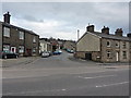
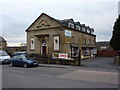
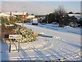
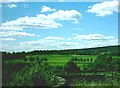
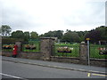
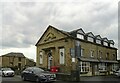
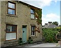
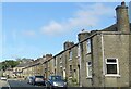
48 photos from this area
Area Information
Key information about the BL7 9SL including its size, population, and administrative classification.
- Area Type
- Postcode
- Area Size
- 4744 m²
- Population
- 1620
- Population Density
- 660 people/km²
House Prices in BL7 9SL
12
Properties
£317,625
Average Sold Price
£97,000
Lowest Price
£820,000
Highest Price
Showing 12 properties
| Address | Type | Beds | Baths | Last Sale Price | Last Sale Date | |
|---|---|---|---|---|---|---|
| 20 Egerton Vale, Egerton, Bolton, BL7 9SL | Cottage | 2 | 1 | £265,000 | Dec 2023 | |
| Standen Manor, Union Street, Egerton, Bolton, BL7 9SL | Detached | 6 | 5 | £820,000 | Nov 2023 | |
| 6 Egerton Vale, Egerton, Bolton, BL7 9SL | Cottage | 3 | 2 | £290,000 | Feb 2022 | |
| 24 Egerton Vale, Egerton, Bolton, BL7 9SL | Terraced | 2 | 1 | £180,000 | Dec 2017 | |
| 8 Egerton Vale, Egerton, Bolton, BL7 9SL | Cottage | 2 | 2 | £244,000 | Dec 2017 | |
| 22 Egerton Vale, Egerton, Bolton, BL7 9SL | house | 2 | 1 | £180,000 | Oct 2016 | |
| 15-17 Egerton Vale, Egerton, Bolton, BL7 9SL | Detached | - | - | £465,000 | Sep 2009 | |
| 18 Egerton Vale, Egerton, Bolton, BL7 9SL | house | 2 | 1 | £97,000 | Dec 2003 | |
| Dewhurst Old Barn, Egerton Vale, Egerton, Bolton, BL7 9SL | Semi-detached | 4 | 2 | - | - | |
| 1 Egerton Vale, Egerton, Bolton, BL7 9SL | Flat | - | - | - | - |
Page 1 of 2
Energy Efficiency in BL7 9SL
Amenities
Schools
| Rank | School | Type | Entry gender | Ages |
|---|
Explore more schools in this area
Go to Schools tabDemographics
Household Size
Two person
most common
Accommodation Type
Houses
most common
Tenure
83
majority
Ethnic Group
White
most common
Religion
N/A
most common
Household Composition
N/A
most common
Age
47
median
Adults (30-64 years)
most common
Household Deprivation
N/A
with no deprivation
NS-SEC
50
in Lower managerial occupations
Explore more demographic insights in this area
Go to Demographics tabPlanning
Planning Constraints
- Flood RiskPremium
- Ramsar Wetland SitesPremium
- Area of Outstanding Natural BeautyPremium
- Protected Nature ReservePremium
- Protected WoodlandPremium