Area Overview for BL7 9EW
Photos of BL7 9EW

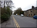
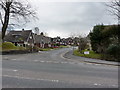


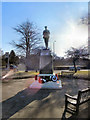
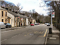

48 photos from this area
Area Information
Key information about the BL7 9EW including its size, population, and administrative classification.
- Area Type
- Postcode
- Area Size
- 5.7 hectares
- Population
- 1618
- Population Density
- 2167 people/km²
House Prices in BL7 9EW
36
Properties
£213,028
Average Sold Price
£51,500
Lowest Price
£540,000
Highest Price
Showing 36 properties
| Address | Type | Beds | Baths | Last Sale Price | Last Sale Date | |
|---|---|---|---|---|---|---|
| 36 Shorefield Mount, Egerton, Bolton, BL7 9EW | Semi-detached | 3 | 1 | £255,500 | Jul 2025 | |
| 50 Shorefield Mount, Egerton, Bolton, BL7 9EW | house | - | - | £240,000 | Feb 2025 | |
| 64 Shorefield Mount, Egerton, Bolton, BL7 9EW | Detached | 4 | 3 | £540,000 | Jan 2022 | |
| 55 Shorefield Mount, Egerton, Bolton, BL7 9EW | Semi-detached | 3 | 2 | £255,000 | Oct 2020 | |
| 63 Shorefield Mount, Egerton, Bolton, BL7 9EW | Detached | 6 | 2 | £393,000 | Apr 2019 | |
| 51 Shorefield Mount, Egerton, Bolton, BL7 9EW | Semi-detached | 3 | 2 | £177,000 | Mar 2014 | |
| 73 Shorefield Mount, Egerton, Bolton, BL7 9EW | Detached | 4 | - | £295,000 | Mar 2014 | |
| 54 Shorefield Mount, Egerton, Bolton, BL7 9EW | Bungalow | 2 | 1 | £165,000 | Oct 2013 | |
| 77 Shorefield Mount, Egerton, Bolton, BL7 9EW | house | - | - | £295,000 | Mar 2011 | |
| 44 Shorefield Mount, Egerton, Bolton, BL7 9EW | Terraced | - | - | £295,000 | Jun 2007 |
Page 1 of 4
Energy Efficiency in BL7 9EW
Amenities
Schools
| Rank | School | Type | Entry gender | Ages |
|---|
Explore more schools in this area
Go to Schools tabDemographics
Household Size
Two person
most common
Accommodation Type
Houses
most common
Tenure
89
majority
Ethnic Group
White
most common
Religion
N/A
most common
Household Composition
N/A
most common
Age
47
median
Adults (30-64 years)
most common
Household Deprivation
N/A
with no deprivation
NS-SEC
48
in Lower managerial occupations
Explore more demographic insights in this area
Go to Demographics tabPlanning
Planning Constraints
- Flood RiskPremium
- Ramsar Wetland SitesPremium
- Area of Outstanding Natural BeautyPremium
- Protected Nature ReservePremium
- Protected WoodlandPremium