Area Overview for BL7 9BG
Photos of BL7 9BG
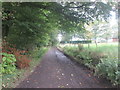
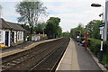
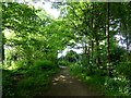
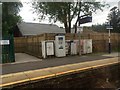
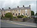
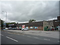
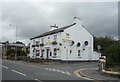
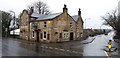
52 photos from this area
Area Information
Key information about the BL7 9BG including its size, population, and administrative classification.
- Area Type
- Postcode
- Area Size
- 8387 m²
- Population
- 1517
- Population Density
- 2396 people/km²
House Prices in BL7 9BG
20
Properties
£212,769
Average Sold Price
£94,500
Lowest Price
£336,000
Highest Price
Showing 20 properties
| Address | Type | Beds | Baths | Last Sale Price | Last Sale Date | |
|---|---|---|---|---|---|---|
| 111 Darwen Road, Bromley Cross, Bolton, BL7 9BG | Semi-detached | 3 | 1 | £295,000 | Feb 2025 | |
| 121 Darwen Road, Bromley Cross, Bolton, BL7 9BG | Semi-detached | 3 | 1 | £280,000 | Sep 2023 | |
| 115 Darwen Road, Bromley Cross, Bolton, BL7 9BG | house | 3 | 1 | £336,000 | Aug 2022 | |
| 117 Darwen Road, Bromley Cross, Bolton, BL7 9BG | Semi-detached | 3 | 1 | £225,000 | Apr 2021 | |
| 113 Darwen Road, Bromley Cross, Bolton, BL7 9BG | house | - | - | £262,500 | Jan 2021 | |
| 147 Darwen Road, Bromley Cross, Bolton, BL7 9BG | Terraced | 2 | 1 | £140,000 | Oct 2020 | |
| 119 Darwen Road, Bromley Cross, Bolton, BL7 9BG | Semi-detached | 3 | 1 | £256,500 | Apr 2020 | |
| 139 Darwen Road, Bromley Cross, Bolton, BL7 9BG | house | - | - | £120,000 | Sep 2019 | |
| 135 Darwen Road, Bromley Cross, Bolton, BL7 9BG | house | - | - | £107,500 | Jul 2009 | |
| 123 Darwen Road, Bromley Cross, Bolton, BL7 9BG | Detached | - | - | £272,000 | Jul 2008 |
Page 1 of 2
Energy Efficiency in BL7 9BG
Amenities
Schools
| Rank | School | Type | Entry gender | Ages |
|---|
Explore more schools in this area
Go to Schools tabDemographics
Household Size
Two person
most common
Accommodation Type
Houses
most common
Tenure
87
majority
Ethnic Group
White
most common
Religion
N/A
most common
Household Composition
N/A
most common
Age
47
median
Adults (30-64 years)
most common
Household Deprivation
N/A
with no deprivation
NS-SEC
43
in Lower managerial occupations
Explore more demographic insights in this area
Go to Demographics tabPlanning
Planning Constraints
- Flood RiskPremium
- Ramsar Wetland SitesPremium
- Area of Outstanding Natural BeautyPremium
- Protected Nature ReservePremium
- Protected WoodlandPremium