Area Overview for BL7 0HB
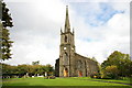
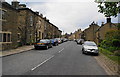
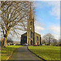
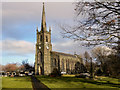
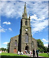
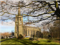
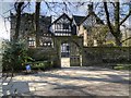
Photos of BL7 0HB
Area Information
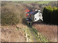
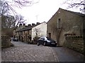
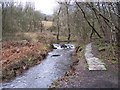
BL7 0HB is a small, tightly knit residential area in North Turton, Lancashire, with a population of 1,902 spread across 12 hectares. Its compact size means it feels intimate, with a quiet, low-density character. Historically part of the township of Turton, the area lies between Bolton and Blackburn, blending rural tranquillity with proximity to urban amenities. Daily life here is defined by its modest scale—fewer than 200 people per square kilometre—and a community skewed toward middle-aged adults (30–64 years), many of whom own their homes. The area’s charm lies in its simplicity: no sprawling developments, just a cluster of houses with easy access to nearby towns via rail and road. Residents benefit from a mix of local services, including primary schools and retail outlets, while the surrounding landscape offers a sense of openness. For those seeking a peaceful, stable environment with a strong sense of local identity, BL7 0HB offers a snapshot of traditional northern English living.
- Area Type
- Postcode
- Area Size
- 12.0 hectares
- Population
- 1902
- Population Density
- 66 people/km²
BL7 0HB is predominantly an owner-occupied area, with 85% of homes owned by residents rather than rented. The housing stock is almost entirely composed of houses, with no flats listed in the data, suggesting a preference for standalone properties. Given the area’s small size—just 12 hectares—the housing market is limited, making it a niche market for buyers seeking a quiet, low-density environment. The compact nature of the area means that property values are likely influenced more by proximity to amenities and transport links than by the size of the housing stock. For buyers, this means competition may be lower than in larger towns, but the range of properties available will be narrower. The high home ownership rate also implies a stable market, with fewer rental properties to consider.
House Prices in BL7 0HB
Showing 3 properties
| Address | Type | Beds | Baths | Last Sale Price | Last Sale Date | |
|---|---|---|---|---|---|---|
| Station House, Station Road, Turton, Bolton, BL7 0HB | house | 4 | 4 | £265,000 | Feb 2004 | |
| Ivory House, 64 Station Road, Turton, Bolton, BL7 0HB | Detached | 4 | 3 | - | - | |
| The Gatehouse Lodge, Station Road, Turton, Bolton, BL7 0HB | house | - | - | - | - |
Energy Efficiency in BL7 0HB
Residents of BL7 0HB have access to a range of nearby amenities that support daily life. The area’s retail options include Co-op Bromley, Sainsburys Bolton, and Spar, providing essentials like groceries and household items. For transport, five railway stations and four metro stops offer connections to nearby towns, facilitating commuting and travel. While the data does not specify parks or leisure facilities, the area’s low population density suggests open spaces may be available nearby. The presence of schools, retail, and transport links creates a functional lifestyle, with residents able to meet most needs locally. However, the lack of detailed information on leisure or recreational facilities means those prioritising parks, gyms, or cultural venues may need to look beyond the immediate area.
Amenities
Schools
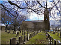
Residents of BL7 0HB have access to a mix of primary and special schools. Turton and Edgworth CofE/Methodist Controlled Primary School, rated ‘good’ by Ofsted, serves younger children, while Crowthorn School and Lower Pastures, both special schools, cater to students with specific educational needs. Lower Pastures is also rated ‘good’, indicating a commitment to quality education across different age groups and requirements. The presence of special schools suggests the area supports families with children who need tailored learning environments. However, the absence of secondary schools means students may need to travel to nearby towns for further education. This mix of school types ensures a range of options for families, though the lack of a comprehensive school system is a consideration for those requiring full-time local education.
| Rank | School | Type | Entry gender | Ages |
|---|
Explore more schools in this area
Go to Schools tabDemographics
The population of BL7 0HB is 1,902, with a median age of 47 and 85% of residents owning their homes. This suggests a mature, settled community, with the majority of households being adults aged 30–64. The area is predominantly composed of houses rather than flats, reflecting a preference for larger properties. The predominant ethnic group is White, which aligns with broader trends in the region. With a population density of 66 people per square kilometre, the area is sparsely populated, offering more space per resident than many urban centres. This low density, combined with high home ownership, indicates a community focused on stability and long-term residency. The age profile suggests a population less reliant on childcare services, though the presence of primary and special schools nearby caters to younger families.
Household Size
Accommodation Type
Tenure
Ethnic Group
Religion
Household Composition
Age
Household Deprivation
NS-SEC
Explore more demographic insights in this area
Go to Demographics tabPlanning
Planning Constraints
- Flood RiskPremium
- Ramsar Wetland SitesPremium
- Area of Outstanding Natural BeautyPremium
- Protected Nature ReservePremium
- Protected WoodlandPremium