Area Overview for BL7 0FS
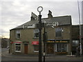
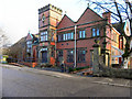
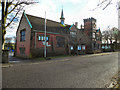
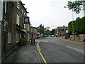
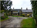
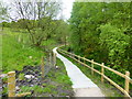
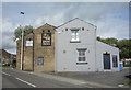
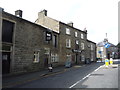
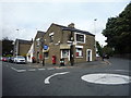
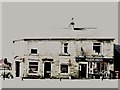
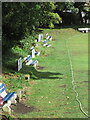
Photos of BL7 0FS

Area Information
BL7 0FS is a compact residential postcode area in England, covering just 1.1 hectares and home to 1,334 residents. Its population density of 1,170 people per square kilometre reflects a tightly knit community, typical of smaller urban clusters. Situated in the North Turton civil parish, historically part of Bolton le Moors, the area lies between Bolton and Blackburn, blending rural charm with proximity to larger towns. Daily life here is shaped by its modest size and historical roots, with residents benefiting from nearby transport links and local amenities. The area’s character is defined by its mix of traditional housing and practical infrastructure, catering to a population predominantly in their 30s to 60s. While small, BL7 0FS offers a balance of accessibility and seclusion, making it appealing to those seeking a stable, community-focused environment without the pressures of larger cities. Its location ensures residents are within reach of key services, from retail to public transport, while retaining a distinct local identity.
- Area Type
- Postcode
- Area Size
- 1.1 hectares
- Population
- 1334
- Population Density
- 1170 people/km²
BL7 0FS is a predominantly owner-occupied area, with 84% of homes owned by their residents rather than rented. The housing stock is almost exclusively houses, which is unusual for smaller postcode areas and suggests a focus on family homes or larger properties. This composition indicates a market where property buyers are likely to be purchasing for long-term residence rather than investment. The high home ownership rate and the absence of flats or apartments may appeal to those seeking spacious, traditional housing. However, the area’s small size—just 1.1 hectares—means the housing stock is limited, and buyers should consider the immediate surrounding areas for more options. The concentration of houses also implies a quieter, more residential character, which may be attractive to those prioritising privacy over urban density. For investors, the market may be less dynamic, with fewer rental properties to target.
House Prices in BL7 0FS
Showing 23 properties
| Address | Type | Beds | Baths | Last Sale Price | Last Sale Date | |
|---|---|---|---|---|---|---|
| 16 Springvale, Edgworth, Bolton, BL7 0FS | Terraced | 4 | 2 | £400,000 | Oct 2025 | |
| 12 Springvale, Edgworth, Bolton, BL7 0FS | Flat | 2 | 2 | £205,000 | Mar 2025 | |
| 1 Springvale, Edgworth, Bolton, BL7 0FS | Flat | - | - | £197,500 | Jan 2025 | |
| 6 Springvale, Edgworth, Bolton, BL7 0FS | Flat | - | - | £212,000 | Dec 2024 | |
| 19 Springvale, Edgworth, Bolton, BL7 0FS | Terraced | 3 | 3 | £425,000 | Jul 2023 | |
| 15 Springvale, Edgworth, Bolton, BL7 0FS | Semi-detached | 4 | 2 | £395,000 | Oct 2022 | |
| 5 Springvale, Edgworth, Bolton, BL7 0FS | Flat | - | - | £172,000 | Dec 2020 | |
| 20 Springvale, Edgworth, Bolton, BL7 0FS | Semi-detached | 4 | 1 | £295,000 | Mar 2020 | |
| 13 Springvale, Edgworth, Bolton, BL7 0FS | Flat | - | - | £155,000 | Oct 2015 | |
| 17 Springvale, Edgworth, Bolton, BL7 0FS | Semi-detached | 4 | 3 | £270,000 | Mar 2015 |
Energy Efficiency in BL7 0FS
Residents of BL7 0FS enjoy access to a range of nearby amenities within practical reach. Retail options include Co-op Bromley, Co-op Holcombe, and Sainsburys Bolton, providing essential shopping and grocery needs. The area’s proximity to rail and metro stations, such as Hall i’ th’ Wood and Bury Interchange, ensures convenient travel for commuting or leisure. While specific parks or leisure facilities are not detailed in the data, the presence of multiple transport hubs suggests the area is well-integrated with surrounding services. The combination of local shops and transport links creates a practical lifestyle, supporting both daily errands and broader mobility. For families or professionals, this balance of accessibility and small-area convenience may be a key draw, though the lack of detailed recreational data means the full extent of leisure opportunities remains unexplored.
Amenities
Schools
| Rank | School | Type | Entry gender | Ages |
|---|
Explore more schools in this area
Go to Schools tabDemographics
The community in BL7 0FS is predominantly composed of adults aged 30 to 64, with a median age of 47. This suggests a mature, stable population, likely with established careers and family ties. Home ownership is high, at 84%, indicating a strong presence of long-term residents rather than transient renters. The area is characterised by houses rather than flats, reflecting a preference for single-family dwellings. The predominant ethnic group is White, though no specific data on diversity or deprivation is provided. The age profile and ownership figures imply a low turnover of properties, which can contribute to a sense of continuity and community cohesion. For buyers, this demographic suggests a neighbourhood where property values may be resilient, supported by a consistent demand from local residents. The absence of detailed diversity statistics means the area’s social fabric remains largely unexplored in public data, but the age and ownership trends point to a practical, family-oriented environment.
Household Size
Accommodation Type
Tenure
Ethnic Group
Religion
Household Composition
Age
Household Deprivation
NS-SEC
Explore more demographic insights in this area
Go to Demographics tabPlanning
Planning Constraints
- Flood RiskPremium
- Ramsar Wetland SitesPremium
- Area of Outstanding Natural BeautyPremium
- Protected Nature ReservePremium
- Protected WoodlandPremium