Area Overview for BL7 0DX
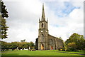
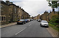
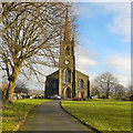
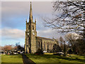
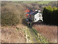
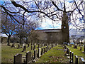
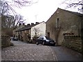
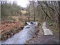
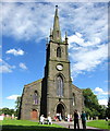
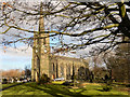
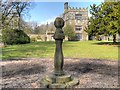
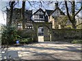
Photos of BL7 0DX
Area Information
BL7 0DX is a small, compact postcode area in England, encompassing a residential cluster of just 3 hectares. With a population of 1,902 spread across 66 people per square kilometre, it is a low-density, quiet community. Situated in North Turton, historically part of the township of Turton in Lancashire, the area lies between Bolton and Blackburn. Its civil parish status and historical roots in the ancient parish of Bolton le Moors give it a distinct local identity. Daily life here is shaped by its rural character, with proximity to nearby towns offering access to services while maintaining a sense of seclusion. The area’s small size means it is likely to feel close-knit, with residents potentially knowing their neighbours. Its location also places it within reach of major transport routes, including railway stations and motorways, though the area itself remains residential rather than commercial. For those seeking a peaceful, low-traffic environment with historical context, BL7 0DX offers a snapshot of traditional northern England.
- Area Type
- Postcode
- Area Size
- 3.0 hectares
- Population
- 1902
- Population Density
- 66 people/km²
BL7 0DX is an owner-occupied area, with 85% of homes owned by residents rather than rented. The accommodation type is predominantly houses, which is typical for a low-density, residential postcode. This suggests a market where properties are likely to be family homes, possibly with gardens or larger living spaces. Given the area’s small size of 3 hectares, the housing stock is limited, and the immediate surroundings may offer few additional options for buyers. The high home ownership rate indicates a lack of rental demand, which could mean properties are held by long-term residents rather than investors. For buyers, this could translate to a stable market with fewer speculative pressures. However, the limited size of the area means that property availability is constrained, and those seeking homes here may need to consider nearby postcodes for more options.
House Prices in BL7 0DX
Showing 8 properties
| Address | Type | Beds | Baths | Last Sale Price | Last Sale Date | |
|---|---|---|---|---|---|---|
| 58 Birches Road, Turton, Bolton, BL7 0DX | Terraced | 2 | 1 | £288,000 | Mar 2025 | |
| 60 Birches Road, Turton, Bolton, BL7 0DX | house | - | - | £190,000 | Nov 2023 | |
| 52 Birches Road, Turton, Bolton, BL7 0DX | Terraced | 2 | 1 | £197,500 | Jul 2017 | |
| 54-56 Birches Road, Turton, Bolton, BL7 0DX | Cottage | 4 | 2 | £280,000 | May 2017 | |
| 46 Birches Road, Turton, Bolton, BL7 0DX | house | - | - | £172,500 | Oct 1997 | |
| Eller Grove, 68 Birches Road, Turton, Bolton, BL7 0DX | Detached | 6 | 4 | - | - | |
| 70 Birches Road, Turton, Bolton, BL7 0DX | undefined | - | - | - | - | |
| 48-50 Birches Road, Turton, Bolton, BL7 0DX | Terraced | - | - | - | - |
Energy Efficiency in BL7 0DX
Residents of BL7 0DX have access to essential amenities within practical reach. Nearby retail options include Co-op Bromley, Sainsburys Bolton, and Morrisons Top O, providing grocery and daily shopping convenience. The area’s proximity to railway stations like Entwistle and Bromley Cross, as well as metro hubs such as Ramsbottom and Bury Interchange, ensures connectivity to larger towns and cities. While the area itself is residential, its location near major transport routes allows for easy access to leisure, employment, and services in nearby towns. The low population density and historical context suggest a lifestyle centred on community and quiet living, with local amenities meeting basic needs. The absence of extensive parks or leisure facilities means residents may need to travel for recreational activities, but the area’s small size fosters a sense of simplicity and proximity to nature.
Amenities
Schools
Residents of BL7 0DX have access to a range of schools, including Turton and Edgworth CofE/Methodist Controlled Primary School, which holds an Ofsted rating of ‘good’. This primary school serves the local community and is likely a key draw for families. Crowthorn School and Lower Pastures are both special schools, catering to students with specific educational needs. The presence of a primary school with a good rating and two special schools indicates a comprehensive educational offering. Families with children may benefit from the variety of school types, ensuring options for both mainstream and specialist education. However, the absence of secondary schools in the immediate area means students may need to commute to nearby towns for further education. This mix of school types reflects the area’s role as a residential hub with focused local amenities.
| Rank | School | Type | Entry gender | Ages |
|---|
Explore more schools in this area
Go to Schools tabDemographics
The community in BL7 0DX is predominantly composed of adults aged 30–64, with a median age of 47. This suggests a stable, middle-aged population, likely with established careers and families. Home ownership is high at 85%, indicating a strong presence of long-term residents rather than transient renters. The area’s accommodation is primarily houses, reflecting a suburban or semi-rural layout. The predominant ethnic group is White, with no specific data provided on other demographics. The population density of 66 people per square kilometre is low, reinforcing the area’s quiet, spread-out nature. This demographic profile implies a community focused on stability and family life, with limited pressure from high population growth. The absence of detailed diversity data means the area’s social composition remains largely defined by its historical and geographical context.
Household Size
Accommodation Type
Tenure
Ethnic Group
Religion
Household Composition
Age
Household Deprivation
NS-SEC
Explore more demographic insights in this area
Go to Demographics tabPlanning
Planning Constraints
- Flood RiskPremium
- Ramsar Wetland SitesPremium
- Area of Outstanding Natural BeautyPremium
- Protected Nature ReservePremium
- Protected WoodlandPremium