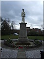
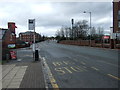
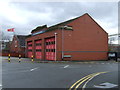
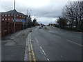
Area Overview for BL6 7QN
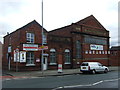
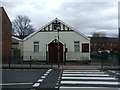
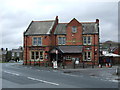
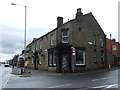
Photos of BL6 7QN
Area Information
Living in BL6 7QN means being part of a tightly knit residential cluster in England’s North West, where 1,723 people reside across 5 hectares. This small area, nestled in the Metropolitan Borough of Bolton, blends historical roots with modern convenience. The population density of 34,240 people per square kilometre reflects a compact, community-focused environment. Daily life here is shaped by proximity to amenities such as railway stations and local shops, while the area’s heritage as a medieval hunting ground and later industrial hub adds a layer of historical depth. Families and older adults dominate, with the median age at 47 and most residents falling between 30 and 64. The area’s small size fosters a sense of familiarity, though its high population density may mean limited space for expansion. For those seeking a balance between urban accessibility and a quieter residential setting, BL6 7QN offers a mix of practicality and character.
- Area Type
- Postcode
- Area Size
- 5.0 hectares
- Population
- 1723
- Population Density
- 5013 people/km²
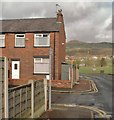
The property market in BL6 7QN is characterised by a 54% home ownership rate, with houses forming the majority of the accommodation stock. This suggests a primarily owner-occupied area, rather than one dominated by rental properties. The small size of the postcode—just 5 hectares—means the housing stock is limited, potentially leading to competition among buyers. The prevalence of houses over flats or apartments may appeal to those seeking larger living spaces, though the area’s compact nature means proximity to amenities is key. For buyers, this small cluster offers a focused market with clear boundaries, but the limited supply could drive prices upward. Those considering the area should weigh the benefits of a tight-knit community against the constraints of a confined geographical footprint.
House Prices in BL6 7QN
Showing 39 properties
| Address | Type | Beds | Baths | Last Sale Price | Last Sale Date | |
|---|---|---|---|---|---|---|
| 115 Crown Lane, Horwich, Bolton, BL6 7QN | Terraced | 3 | 1 | £217,500 | Mar 2025 | |
| 70 Crown Lane, Horwich, Bolton, BL6 7QN | Terraced | 2 | 1 | £210,000 | Apr 2024 | |
| 109 Crown Lane, Horwich, Bolton, BL6 7QN | Terraced | 2 | 2 | £182,500 | Sep 2023 | |
| 66 Crown Lane, Horwich, Bolton, BL6 7QN | Terraced | 2 | 1 | £180,500 | Sep 2022 | |
| 82 Crown Lane, Horwich, Bolton, BL6 7QN | Terraced | 3 | 2 | £138,900 | Feb 2020 | |
| 78 Crown Lane, Horwich, Bolton, BL6 7QN | Terraced | 2 | 1 | £120,000 | Nov 2019 | |
| 102 Crown Lane, Horwich, Bolton, BL6 7QN | Terraced | 3 | 1 | £133,000 | Sep 2019 | |
| 68 Crown Lane, Horwich, Bolton, BL6 7QN | Terraced | 2 | 1 | £110,000 | May 2019 | |
| 118 Crown Lane, Horwich, Bolton, BL6 7QN | Terraced | 2 | 1 | £115,000 | Nov 2018 | |
| 113 Crown Lane, Horwich, Bolton, BL6 7QN | Terraced | 3 | 1 | £120,000 | Oct 2018 |
Energy Efficiency in BL6 7QN
The lifestyle in BL6 7QN is shaped by its proximity to essential amenities. Local retail options include Aldi Wallsuches, Co-op Winter, and Iceland Horwich, offering everyday shopping needs within walking distance. The area’s rail connections to Blackrod, Horwich Parkway, and Adlington provide access to broader regional networks, enabling easy travel to cultural, leisure, and professional hubs. While the data does not mention parks or leisure facilities directly, the nearby Horwich Town Centre Conservation Area and heritage sites suggest a blend of historical interest and community spaces. The compact nature of BL6 7QN means residents can access shops, transport, and local services without long commutes, fostering a convenient, self-contained lifestyle.
Amenities
Schools
BL6 7QN is served by several primary schools, including St Catherine’s CofE Primary School, Horwich, Our Lady of the Rosary RC Primary School, and multiple instances of St Catherine’s CofE Primary School. These institutions cater to the area’s family demographic, providing early education options for young residents. The repetition of school names may indicate multiple campuses or branches, though the data does not clarify this. The presence of multiple primary schools suggests a focus on local education, which is crucial for families with young children. However, the absence of secondary school information means parents may need to look beyond BL6 7QN for comprehensive schooling. The mix of Church of England and Roman Catholic schools reflects the area’s religious diversity, offering parents choices aligned with their preferences.
| Rank | School | Type | Entry gender | Ages |
|---|
Explore more schools in this area
Go to Schools tabDemographics
BL6 7QN’s population skews towards adults aged 30–64, with a median age of 47. This suggests a community centred on families and established professionals, rather than younger singles or retirees. Home ownership stands at 54%, with houses being the predominant accommodation type, indicating a mix of owner-occupied properties and rentals. The majority of residents identify as White, reflecting the area’s demographic profile. With a population density of 34,240 people per square kilometre, the area is highly compact, which may influence the pace of life and availability of private space. While this density could imply a strong sense of community, it also underscores the need for efficient planning to manage resources and services. The data does not indicate significant deprivation, but the high population density may impact local infrastructure and green spaces.
Household Size
Accommodation Type
Tenure
Ethnic Group
Religion
Household Composition
Age
Household Deprivation
NS-SEC
Explore more demographic insights in this area
Go to Demographics tabPlanning
Planning Constraints
- Flood RiskPremium
- Ramsar Wetland SitesPremium
- Area of Outstanding Natural BeautyPremium
- Protected Nature ReservePremium
- Protected WoodlandPremium