Area Overview for BL6 7PJ
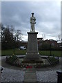
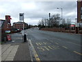
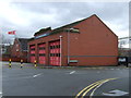
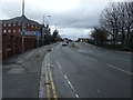
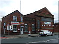
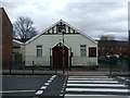
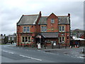
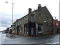
Photos of BL6 7PJ
Area Information
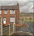
BL6 7PJ is a compact residential postcode in Greater Manchester, encompassing a small cluster of homes with a population of 1,381. Despite its modest size—just 3,231 square metres—the area is densely populated, with 427,375 people per square kilometre. This reflects a tight-knit community, historically rooted in Horwich’s medieval past as a hunting ground for Manchester’s barons. Today, the area is characterised by its mix of older and newer housing stock, with a strong emphasis on owner-occupied homes. Residents benefit from proximity to key amenities, including five retail outlets like Co-op Winter and Aldi Wallsuches, and rail links via Blackrod and Horwich Parkway stations. The area’s compact nature means daily life is centred around local shops, schools, and transport hubs. While the population skews older, with a median age of 47, the presence of a primary school and nearby leisure options suggests a balance between established residents and families. Living here demands awareness of environmental risks, but the area’s historical charm and practical infrastructure make it a distinct choice for those seeking a focused, community-oriented lifestyle.
- Area Type
- Postcode
- Area Size
- 3231 m²
- Population
- 1381
- Population Density
- 4481 people/km²
BL6 7PJ is predominantly an owner-occupied area, with 69% of homes owned by residents rather than rented. The accommodation type is primarily houses, which is unusual for a small postcode but may reflect the area’s suburban layout and historical development. This mix of ownership and housing stock suggests a market where properties are likely to be family homes or long-term investments. The compact size of the postcode means the housing stock is limited, and buyers may need to consider nearby areas for more options. The high home ownership rate indicates a stable market with less rental demand, which could influence property values and availability. For buyers, the focus on houses may appeal to those seeking space, though the small area’s density could limit choices.
House Prices in BL6 7PJ
Showing 14 properties
| Address | Type | Beds | Baths | Last Sale Price | Last Sale Date | |
|---|---|---|---|---|---|---|
| 97 Winter Hey Lane, Horwich, Bolton, BL6 7PJ | Retail | 2 | 1 | £131,100 | Aug 2022 | |
| 105 Winter Hey Lane, Horwich, Bolton, BL6 7PJ | house | - | - | £125,000 | Mar 2021 | |
| 101 Winter Hey Lane, Horwich, Bolton, BL6 7PJ | Cottage | 2 | 1 | £110,000 | Jan 2017 | |
| 107 Winter Hey Lane, Horwich, Bolton, BL6 7PJ | Cottage | 2 | 1 | £63,500 | Oct 2012 | |
| 103 Winter Hey Lane, Horwich, Bolton, BL6 7PJ | Terraced | - | - | £115,000 | Apr 2007 | |
| 99 Winter Hey Lane, Horwich, Bolton, BL6 7PJ | house | - | - | £48,000 | Jul 2001 | |
| 110A Winter Hey Lane, Horwich, Bolton, BL6 7PJ | Flat | - | - | £27,500 | Nov 1995 | |
| Flat Above, 116 Winter Hey Lane, Horwich, Bolton, BL6 7PJ | Retail | - | - | - | - | |
| 108A Winter Hey Lane, Horwich, Bolton, BL6 7PJ | Retail | - | - | - | - | |
| 100A Winter Hey Lane, Horwich, Bolton, BL6 7PJ | Flat | 1 | 1 | - | - |
Energy Efficiency in BL6 7PJ
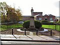
Residents of BL6 7PJ have access to a range of nearby amenities, including five retail outlets such as Co-op Winter, Aldi Wallsuches, and Iceland Horwich. These shops provide everyday essentials, contributing to a self-contained lifestyle. The area’s rail links, with stations like Blackrod and Horwich Parkway, offer easy access to broader regional networks, supporting both commuting and leisure travel. While the data does not mention parks or leisure facilities, the proximity to Horwich’s historical sites, such as the New Chapel and Holy Trinity Church, suggests cultural and heritage opportunities. The compact nature of the area means amenities are within practical reach, enhancing convenience. However, the lack of detailed information on leisure options means residents may need to look beyond the immediate postcode for more diverse activities.
Amenities
Schools
The nearest school to BL6 7PJ is Horwich Parish CofE Primary School, a primary institution with a Good Ofsted rating. This school serves the local community and is likely a key factor for families considering the area. The presence of a primary school suggests that the area is suitable for raising children, though no secondary schools are listed in the data. The Good rating indicates that the school meets quality standards, providing a reliable educational option for younger residents. Families may need to look further afield for secondary education, but the primary school’s proximity offers convenience. The school’s listed status and historical significance, as noted in local research, add to its appeal as a community anchor.
| Rank | School | Type | Entry gender | Ages |
|---|
Explore more schools in this area
Go to Schools tabDemographics
The population of BL6 7PJ is predominantly adults aged 30–64, with a median age of 47. This suggests a mature, stable community with fewer young families compared to other areas. Home ownership is high at 69%, indicating a strong presence of long-term residents. The accommodation is primarily houses, reflecting a suburban or semi-rural character. The predominant ethnic group is White, with no data provided on other demographics. The high population density—427,375 people per square kilometre—means the area is intensely populated for its size, which can influence local services and infrastructure. While the data does not specify deprivation levels, the high home ownership and age profile suggest a relatively affluent, settled population. However, the concentration of residents in a small area may impact housing availability and community dynamics.
Household Size
Accommodation Type
Tenure
Ethnic Group
Religion
Household Composition
Age
Household Deprivation
NS-SEC
Explore more demographic insights in this area
Go to Demographics tabPlanning
Planning Constraints
- Flood RiskPremium
- Ramsar Wetland SitesPremium
- Area of Outstanding Natural BeautyPremium
- Protected Nature ReservePremium
- Protected WoodlandPremium