Area Overview for BL6 7EP
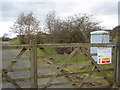
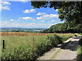
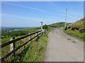
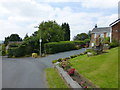
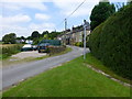
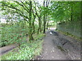
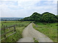
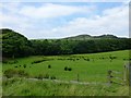
Photos of BL6 7EP


Area Information
BL6 7EP is a compact residential area in Greater Manchester, nestled within the town of Horwich. With a population of 1,281 and a population density of 174,943 people per square kilometre, this postcode covers just 7,322 square metres, making it a tightly knit community. The area’s historical roots as a medieval hunting ground and later industrial hub shape its character today, blending traditional architecture with modern infrastructure. Residents benefit from proximity to rail networks, with stations like Blackrod and Horwich Parkway offering connections to major cities. Daily life here is defined by convenience: five retail outlets, including Sainsburys and Aldi, cater to local needs, while the dense housing stock suggests a focus on family homes. The area’s small size means neighbours are likely to be familiar faces, though the high population density may create a sense of closeness that some find comforting and others challenging. For buyers, BL6 7EP offers a snapshot of a typical suburban English town, where practicality meets historical continuity.
- Area Type
- Postcode
- Area Size
- 7322 m²
- Population
- 1281
- Population Density
- 3411 people/km²
BL6 7EP is a predominantly owner-occupied area, with 66% of properties owned by residents. The housing stock is almost entirely composed of houses, which is unusual for a small postcode area and suggests a focus on family homes rather than apartments or flats. This configuration may appeal to buyers seeking larger properties with private outdoor space, though the limited area size means the housing stock is concentrated within a small geographical footprint. The high proportion of owner-occupation indicates a market where long-term residency is the norm, with fewer rental properties available. For buyers, this could mean limited competition for homes, but also fewer options for short-term or flexible living. The small size of the area also means that properties are likely to be in close proximity to local amenities, though the density may impact privacy and noise levels.
House Prices in BL6 7EP
Showing 5 properties
| Address | Type | Beds | Baths | Last Sale Price | Last Sale Date | |
|---|---|---|---|---|---|---|
| 167 Brownlow Road, Horwich, Bolton, BL6 7EP | Semi-detached | 5 | 2 | £400,000 | Jan 2021 | |
| 169 Brownlow Road, Horwich, Bolton, BL6 7EP | Semi-detached | 4 | 1 | £215,000 | Jan 2017 | |
| 163 Brownlow Road, Horwich, Bolton, BL6 7EP | house | - | - | £85,000 | May 2014 | |
| 171 Brownlow Road, Horwich, Bolton, BL6 7EP | Semi-detached | - | - | £102,000 | Jul 2000 | |
| 165 Brownlow Road, Horwich, Bolton, BL6 7EP | Semi-detached | - | - | - | - |
Energy Efficiency in BL6 7EP
Residents of BL6 7EP have access to a range of practical amenities within walking or short driving distance. The area is served by five retail outlets, including Sainsburys Horwich, Co-op Winter, and Aldi Wallsuches, ensuring everyday shopping needs are met. Rail connectivity is strong, with five stations nearby, including Blackrod and Horwich Parkway, offering regular services to Manchester and beyond. While the data does not mention parks or leisure facilities, the presence of a town centre conservation area and historical sites like Holy Trinity Church suggests a mix of practical and cultural offerings. The compact nature of the area means amenities are closely clustered, though the high population density may lead to congestion in public spaces. For buyers, the combination of retail access and rail links supports a lifestyle that balances convenience with the possibility of quieter, more private living.
Amenities
Schools
| Rank | School | Type | Entry gender | Ages |
|---|
Explore more schools in this area
Go to Schools tabDemographics
The community in BL6 7EP is predominantly middle-aged, with a median age of 47 and the majority of residents falling within the 30-64 age range. This suggests a stable population of working-age adults, many of whom are likely to be homeowners. Home ownership here is robust, with 66% of properties owned by residents rather than rented. The accommodation type is almost exclusively houses, reflecting a preference for larger, more private living spaces. The predominant ethnic group is White, though no specific diversity statistics are available. The high proportion of owner-occupied homes indicates a settled, long-term demographic, with fewer transient residents. This stability may contribute to a strong sense of community, though the area’s small size and high density could also lead to limited social stratification. For buyers, the age profile and home ownership rate suggest a market skewed toward established families seeking long-term residency.
Household Size
Accommodation Type
Tenure
Ethnic Group
Religion
Household Composition
Age
Household Deprivation
NS-SEC
Explore more demographic insights in this area
Go to Demographics tabPlanning
Planning Constraints
- Flood RiskPremium
- Ramsar Wetland SitesPremium
- Area of Outstanding Natural BeautyPremium
- Protected Nature ReservePremium
- Protected WoodlandPremium