Area Overview for BL6 7BY
Photos of BL6 7BY


Area Information
Living in BL6 7BY means inhabiting a small, densely populated residential cluster in Horwich, part of Bolton’s Metropolitan Borough. The area covers just 4,814 square metres, housing 1,381 people with a population density of 286,848 per square kilometre. This compactness fosters a tight-knit community, though space is limited. Historically, Horwich was a medieval hunting ground, later evolving into a town with 19th-century railway developments. Today, it balances heritage with modern needs. Residents benefit from nearby amenities: five retail outlets, including Sainsburys and Co-op, and five rail stations, such as Horwich Parkway, offering easy access to Greater Manchester. The area’s proximity to schools and transport links makes it practical for families and commuters. However, its small size means limited expansion, and buyers must consider the high population density. BL6 7BY is not for those seeking sprawling landscapes, but it offers convenience and a sense of local identity rooted in its history.
- Area Type
- Postcode
- Area Size
- 4814 m²
- Population
- 1381
- Population Density
- 4481 people/km²
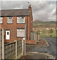
BL6 7BY’s property market is defined by high home ownership (69%) and a predominance of houses. This suggests a market skewed towards owner-occupiers rather than renters, with limited availability of flats or apartments. The small area size—just 4,814 square metres—means the housing stock is tightly packed, potentially limiting scope for new developments. For buyers, this implies competition for existing properties, particularly as the area’s compact nature restricts expansion. The focus on houses may appeal to families seeking space, though the high population density could impact privacy. Proximity to rail stations like Horwich Parkway adds value for commuters, but the small footprint means buyers must weigh the benefits of convenience against the constraints of a densely populated environment. The market’s character is shaped by its historical roots and the need for buyers to consider both practicality and long-term viability.
House Prices in BL6 7BY
Showing 12 properties
| Address | Type | Beds | Baths | Last Sale Price | Last Sale Date | |
|---|---|---|---|---|---|---|
| 10 Lee Lane, Horwich, Bolton, BL6 7BY | Cottage | 2 | 1 | £95,000 | Feb 2014 | |
| 4 Lee Lane, Horwich, Bolton, BL6 7BY | Cottage | 3 | - | £150,000 | Feb 2014 | |
| 2 Lee Lane, Horwich, Bolton, BL6 7BY | Semi-detached | - | - | £125,000 | Sep 2012 | |
| 8 Lee Lane, Horwich, Bolton, BL6 7BY | house | - | - | £61,572 | Mar 2010 | |
| Lbh Accountancy Services Ltd, First And Second Floors, Craven House, 32 Lee Lane, Horwich, Bolton, BL6 7BY | Office | - | - | - | - | |
| Cash Access Uk Limited, Part Ground Floor, Craven House, 32 Lee Lane, Horwich, Bolton, BL6 7BY | Retail | - | - | - | - | |
| Unit 1, Craven House, 32 Lee Lane, Horwich, Bolton, BL6 7BY | Office | - | - | - | - | |
| Unit 2, Craven House, 32 Lee Lane, Horwich, Bolton, BL6 7BY | shop | - | - | - | - | |
| 6 Lee Lane, Horwich, Bolton, BL6 7BY | Terraced | - | - | - | - | |
| 12 Lee Lane, Horwich, Bolton, BL6 7BY | Terraced | - | - | - | - |
Energy Efficiency in BL6 7BY
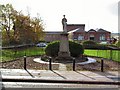
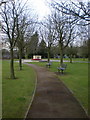
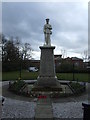
BL6 7BY’s lifestyle is shaped by its proximity to essential amenities. Five retail outlets, including Sainsburys Horwich and Co-op Winter, provide everyday shopping convenience, while Iceland Horwich caters to specific needs. The rail network offers easy access to nearby towns and cities, enhancing mobility for commuters and leisure travellers. Though the area’s small size limits expansive parks or recreational spaces, its compact nature encourages a walkable community. The presence of historic sites like Holy Trinity Church and the Horwich Heritage Centre adds cultural depth, though these are not listed as amenities in the data. For residents, the balance of practical retail, transport links, and historical context creates a functional yet characterful environment. The density of services ensures daily life is efficient, though space for larger leisure activities may require venturing beyond the postcode.
Amenities
Schools
The nearest school to BL6 7BY is Horwich Parish CofE Primary School, a primary institution with a ‘good’ Ofsted rating. This school serves the local community, offering education for younger children. However, no secondary schools are listed in the data, meaning families may need to look beyond BL6 7BY for secondary education. The presence of a primary school with a positive rating is a key draw for families, ensuring access to quality early education. The absence of secondary options could be a limitation, though nearby towns in Greater Manchester may provide alternatives. The school’s status as a listed premises from 1832 adds historical significance to the area. For parents prioritising proximity to schools, BL6 7BY’s primary offering is a strength, but planning for secondary schooling requires additional research.
| Rank | School | Type | Entry gender | Ages |
|---|
Explore more schools in this area
Go to Schools tabDemographics
BL6 7BY’s population of 1,381 is predominantly middle-aged, with a median age of 47 and 69% of residents owning their homes. The most common age range is 30–64, suggesting a community of established professionals and families. The area is largely composed of houses, reflecting a preference for single-family living. The predominant ethnic group is White, though specific diversity statistics are not provided. With 69% home ownership, the area leans towards owner-occupied properties rather than rentals, indicating stability. However, the high population density—286,848 per square kilometre—raises questions about housing pressure. The absence of detailed deprivation data means it’s unclear how economic challenges might affect quality of life. For buyers, the demographic profile suggests a mature, settled community, though the lack of younger residents could influence local services and amenities.
Household Size
Accommodation Type
Tenure
Ethnic Group
Religion
Household Composition
Age
Household Deprivation
NS-SEC
Explore more demographic insights in this area
Go to Demographics tabPlanning
Planning Constraints
- Flood RiskPremium
- Ramsar Wetland SitesPremium
- Area of Outstanding Natural BeautyPremium
- Protected Nature ReservePremium
- Protected WoodlandPremium