Area Overview for BL6 6WA
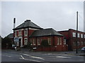
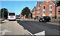
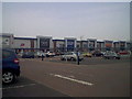
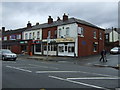
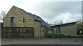
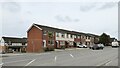
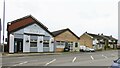
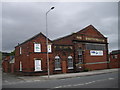
Photos of BL6 6WA
Area Information
BL6 6WA is a compact residential postcode nestled in the town of Horwich, part of Bolton’s Metropolitan Borough in Greater Manchester. With a population of 2,133 and a density of 781 people per square kilometre, it reflects a tightly knit community. Historically a medieval hunting ground, Horwich evolved into a town with industrial roots, including 19th-century railway workshops that shaped its growth. Today, the area balances its heritage with modern living, offering proximity to retail hubs like Co-op Chorley and Asda Horwich, as well as rail connections to Horwich Parkway and Blackrod stations. Daily life here is shaped by its small-scale character, where families and older residents coexist. The presence of three primary schools, including Chorley New Road Primary Academy, underscores its appeal to households with children. While the area lacks sprawling green spaces, its strategic location within Greater Manchester ensures access to urban amenities without the congestion of larger cities. For buyers seeking a quieter, community-focused environment with practical connectivity, BL6 6WA offers a blend of historical charm and functional modernity.
- Area Type
- Postcode
- Area Size
- Not available
- Population
- 2133
- Population Density
- 781 people/km²
The property market in BL6 6WA is dominated by owner-occupied homes, with 71% of properties in private ownership. The accommodation type is predominantly houses, indicating a focus on family-friendly, single-unit dwellings rather than apartments or terraced housing. This suggests a market geared towards established households seeking stability, rather than young professionals or investors. The small postcode area implies limited housing stock, which may result in a competitive market for buyers. Given the high home ownership rate, rental options are likely scarce, making BL6 6WA less attractive to those seeking short-term lets. The presence of nearby retail and rail connections adds value, though the area’s compact size means buyers must consider proximity to secondary schools and other amenities beyond the immediate postcode. For those prioritising a home with a garden and a sense of community, the area offers a viable option, albeit with limited scope for expansion.
House Prices in BL6 6WA
No properties found in this postcode.
Energy Efficiency in BL6 6WA
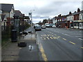
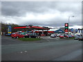
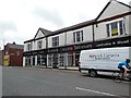
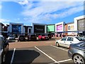
Residents of BL6 6WA enjoy a range of nearby amenities, including five retail outlets such as Co-op Chorley, M&S Middlebrook, and Asda Horwich, ensuring everyday shopping needs are met. The area’s rail network, with stations like Horwich Parkway and Blackrod, facilitates easy access to broader Greater Manchester. While specific parks or leisure facilities are not detailed in the data, the proximity to Horwich’s town centre and its conservation area suggests opportunities for local walks or cultural activities. The presence of multiple retail and transport hubs contributes to a convenient lifestyle, reducing the need for long trips. For families, the combination of schools and shops creates a self-contained environment, though those seeking larger green spaces may need to look beyond the immediate postcode. The area’s compact size fosters a sense of community, with amenities designed for practical, daily use.
Amenities
Schools
Residents of BL6 6WA have access to three primary schools within practical reach. Chorley New Road Primary School and Chorley New Road Primary Academy cater to younger children, while St Joseph’s RC High School, though listed as a primary school, holds a satisfactory Ofsted rating. This mix of state and faith-based institutions provides families with choices, though secondary education options are not explicitly mentioned in the data. The presence of multiple primary schools suggests the area is well-served for early education, reducing the need for long commutes. However, the lack of detailed performance metrics or secondary school information may be a consideration for families planning long-term. The schools’ proximity to residential areas aligns with the community’s family-oriented profile, reinforcing BL6 6WA’s appeal to households with children.
| Rank | School | Type | Entry gender | Ages |
|---|
Explore more schools in this area
Go to Schools tabDemographics
The community in BL6 6WA is predominantly middle-aged, with a median age of 47 and the most common age range being adults aged 30–64. This suggests a stable population with established households, many of whom own their homes—71% of properties are owner-occupied. The area is characterised by houses rather than flats, reflecting a preference for single-family dwellings. The predominant ethnic group is White, though specific data on diversity is not provided. The age profile indicates a mature demographic, which may influence local services and amenities. With 71% home ownership, the area is less reliant on rental markets, potentially offering long-term stability for residents. However, the absence of detailed data on deprivation or income levels means the full picture of quality of life remains partially obscured. The presence of primary schools and rail links suggests the area caters to families, though the lack of secondary schools may require commuting.
Household Size
Accommodation Type
Tenure
Ethnic Group
Religion
Household Composition
Age
Household Deprivation
NS-SEC
Explore more demographic insights in this area
Go to Demographics tabPlanning
Planning Constraints
- Flood RiskPremium
- Ramsar Wetland SitesPremium
- Area of Outstanding Natural BeautyPremium
- Protected Nature ReservePremium
- Protected WoodlandPremium