Area Overview for BL6 6ST
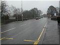
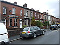
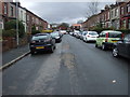
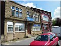
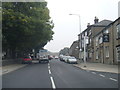
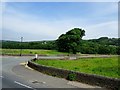
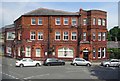
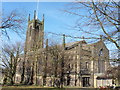
Photos of BL6 6ST


Area Information
BL6 6ST is a small residential postcode area in Greater Manchester, part of the town of Horwich. With a population of 1,476 and a density of 259 people per square kilometre, it is a compact, tightly knit community. Historically a medieval hunting ground, Horwich evolved into a town with 19th-century railway developments shaping its growth. Today, the area is characterised by its mix of traditional housing and proximity to key transport links. Daily life here is grounded in local amenities, with shops, schools, and rail stations within easy reach. The area’s modest size means residents often know their neighbours, fostering a close-knit atmosphere. While the population is predominantly older adults, the presence of schools like Horwich Parish Church of England Primary School suggests families are also part of the community. Living in BL6 6ST offers a balance of quiet residential living and access to urban conveniences, though its small scale means it is best suited for those prioritising community over sprawling infrastructure.
- Area Type
- Postcode
- Area Size
- Not available
- Population
- 1476
- Population Density
- 259 people/km²
BL6 6ST is primarily an owner-occupied area, with 88% of homes owned by residents rather than rented. The accommodation type is predominantly houses, which contrasts with areas dominated by flats or apartments. This suggests a market skewed towards single-family homes, likely appealing to those seeking space and privacy. The small size of the postcode area means the housing stock is limited, with properties concentrated in a compact cluster. For buyers, this implies competition for available homes and a need to consider nearby areas for more options. The high home ownership rate also indicates long-term residency, which can stabilise property values but may limit turnover. Those seeking rental properties may find fewer choices here, making it a less viable option for investors. The focus on houses also means buyers should prioritise properties with outdoor space, a feature less common in urban or high-density areas.
House Prices in BL6 6ST
No properties found in this postcode.
Energy Efficiency in BL6 6ST
Living in BL6 6ST offers access to a range of amenities within practical reach. The area is served by five retail outlets, including Sainsburys Horwich and Co-op Winter, providing everyday shopping needs. For dining, nearby options are not explicitly listed but the presence of retail hubs suggests a variety of local eateries. The rail network, with stations such as Horwich Parkway and Lostock, connects residents to broader regional services, enhancing mobility. While specific parks or leisure facilities are not detailed in the data, the town’s heritage includes conservation areas and historical sites like Holy Trinity Church, offering cultural and recreational value. The area’s lifestyle is defined by convenience—shops, schools, and transport are all within walking or short driving distance. This compactness supports a low-maintenance, community-focused way of life, though those seeking expansive green spaces may need to venture slightly further afield.
Amenities
Schools
| Rank | School | Type | Entry gender | Ages |
|---|
Explore more schools in this area
Go to Schools tabDemographics
The median age in BL6 6ST is 47, with the majority of residents aged between 30 and 64. This suggests a community of established adults, many of whom may be retired or in their later careers. Home ownership is high, at 88%, indicating a stable, long-term resident base. The accommodation type is predominantly houses, which aligns with the area’s residential character. The predominant ethnic group is White, reflecting broader demographic trends in the region. While no specific deprivation data is provided, the high home ownership rate and age profile suggest a relatively stable socioeconomic environment. However, the absence of detailed diversity metrics means the community’s full composition remains partially unexplored. For buyers, this demographic profile implies a focus on family-friendly, low-maintenance properties suited to older homeowners or retirees.
Household Size
Accommodation Type
Tenure
Ethnic Group
Religion
Household Composition
Age
Household Deprivation
NS-SEC
Explore more demographic insights in this area
Go to Demographics tabPlanning
Planning Constraints
- Flood RiskPremium
- Ramsar Wetland SitesPremium
- Area of Outstanding Natural BeautyPremium
- Protected Nature ReservePremium
- Protected WoodlandPremium