Area Overview for BL6 6DN
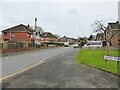
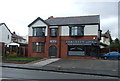
Photos of BL6 6DN


Area Information
BL6 6DN is a small residential postcode area in Horwich, part of Bolton’s Metropolitan Borough in Greater Manchester. With a population of 1,329, it reflects a tight-knit community nestled in a historically significant part of North West England. The area’s character is shaped by its medieval roots, with names like “Har Wice” hinting at its origins as a hunting ground for Manchester’s barons. Today, it balances historic charm with modern convenience, including proximity to railway stations and retail hubs. Daily life here is defined by its compact size and accessibility, with amenities like Co-op Chorley and Asda Horwich within practical reach. The area’s appeal lies in its quiet residential nature, supported by a network of rail links to Blackrod and Lostock, and a population skewed toward adults aged 30–64. While not a sprawling suburb, BL6 6DN offers a blend of local heritage and contemporary living, ideal for those seeking a manageable, community-focused environment.
- Area Type
- Postcode
- Area Size
- Not available
- Population
- 1329
- Population Density
- 1996 people/km²
The property market in BL6 6DN is characterised by a 58% home ownership rate, suggesting a balance between owner-occupied homes and rental properties. The accommodation type is predominantly houses, which implies a residential area with limited high-density development. Given the small population and compact postcode, the housing stock is likely to be modest in scale, with a focus on individual homes rather than larger apartment blocks. For buyers, this means a market where properties are likely to be family-sized homes, possibly with gardens, reflecting the area’s residential nature. The proximity to rail stations and retail hubs may enhance the appeal of properties here, though the limited size of the area means the immediate surroundings are key to assessing potential. Buyers should consider the local market’s dynamics, including the potential for long-term value retention in a stable, low-density environment.
House Prices in BL6 6DN
No properties found in this postcode.
Energy Efficiency in BL6 6DN
The lifestyle in BL6 6DN is shaped by its proximity to retail and transport hubs, offering a mix of practicality and convenience. Nearby amenities include five retail outlets, such as Co-op Chorley, M&S Middlebrook, and Asda Horwich, ensuring residents have access to essential shopping and dining options. The area’s rail network, with stations like Horwich Parkway and Blackrod, connects residents to broader regional networks, facilitating both daily commutes and weekend excursions. While the data does not specify parks or leisure facilities, the presence of historic sites like Holy Trinity Church and the Horwich Heritage Centre suggests a community with cultural and historical interests. The compact nature of the area means that daily life revolves around these local services, making it ideal for those prioritising accessibility over expansive recreational spaces.
Amenities
Schools
The nearest school to BL6 6DN is Claypool Primary School, a primary institution with an Ofsted rating of “good.” This suggests a solid foundation for early education, though no secondary schools are listed in the data. Families with young children may find the primary school’s proximity convenient, but those requiring secondary education would need to look beyond the immediate area. The absence of secondary schools nearby could influence decisions about long-term residency, particularly for households with older children. The school’s rating indicates it meets acceptable standards, but without additional data on performance metrics or facilities, its full capabilities remain unquantified. For parents, the presence of a rated primary school is a positive, though the lack of secondary options may necessitate commuting or exploring alternative schooling arrangements.
| Rank | School | Type | Entry gender | Ages |
|---|
Explore more schools in this area
Go to Schools tabDemographics
The population of BL6 6DN is 1,329, with a median age of 47 and the majority of residents falling within the 30–64 age range. Home ownership here stands at 58%, indicating a mix of owner-occupied and rental properties. The accommodation type is predominantly houses, reflecting a residential cluster rather than high-density housing. The predominant ethnic group is White, though no specific data on diversity or deprivation is provided. This age profile suggests a mature, stable community with a focus on long-term residency. The absence of younger families or students may influence local services and amenities, though the area’s proximity to Claypool Primary School hints at some family presence. The demographic makeup aligns with a place where homeownership is common, and the housing stock is largely composed of individual homes rather than flats or apartments.
Household Size
Accommodation Type
Tenure
Ethnic Group
Religion
Household Composition
Age
Household Deprivation
NS-SEC
Explore more demographic insights in this area
Go to Demographics tabPlanning
Planning Constraints
- Flood RiskPremium
- Ramsar Wetland SitesPremium
- Area of Outstanding Natural BeautyPremium
- Protected Nature ReservePremium
- Protected WoodlandPremium