Area Overview for BL6 6AS
Photos of BL6 6AS
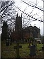
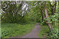
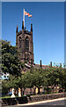
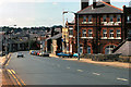
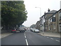
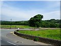
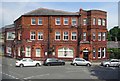
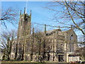
45 photos from this area
Area Information
Key information about the BL6 6AS including its size, population, and administrative classification.
- Area Type
- Postcode
- Area Size
- 7301 m²
- Population
- 1476
- Population Density
- 259 people/km²
House Prices in BL6 6AS
5
Properties
£457,333
Average Sold Price
£395,000
Lowest Price
£495,000
Highest Price
Showing 5 properties
| Address | Type | Beds | Baths | Last Sale Price | Last Sale Date | |
|---|---|---|---|---|---|---|
| Redthorn, Foxholes Road, Horwich, Bolton, BL6 6AS | Detached | 4 | 2 | £495,000 | Aug 2023 | |
| Oakroyd, Foxholes Road, Horwich, Bolton, BL6 6AS | Detached | 4 | 2 | £482,000 | Dec 2017 | |
| Highercroft, Foxholes Road, Horwich, Bolton, BL6 6AS | Detached | 5 | - | £395,000 | Oct 2014 | |
| Cintra, Foxholes Road, Horwich, Bolton, BL6 6AS | Detached | - | - | - | - | |
| Ingledene, Foxholes Road, Horwich, Bolton, BL6 6AS | Detached | - | - | - | - |
Energy Efficiency in BL6 6AS
Amenities
Schools
| Rank | School | Type | Entry gender | Ages |
|---|
Explore more schools in this area
Go to Schools tabDemographics
Household Size
Two person
most common
Accommodation Type
Houses
most common
Tenure
88
majority
Ethnic Group
White
most common
Religion
N/A
most common
Household Composition
N/A
most common
Age
47
median
Adults (30-64 years)
most common
Household Deprivation
N/A
with no deprivation
NS-SEC
52
in Lower managerial occupations
Explore more demographic insights in this area
Go to Demographics tabPlanning
Planning Constraints
- Flood RiskPremium
- Ramsar Wetland SitesPremium
- Area of Outstanding Natural BeautyPremium
- Protected Nature ReservePremium
- Protected WoodlandPremium