Area Overview for BL6 5WJ
Photos of BL6 5WJ
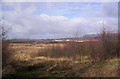
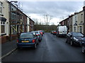
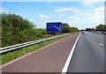
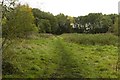
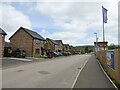

18 photos from this area
Area Information
Key information about the BL6 5WJ including its size, population, and administrative classification.
- Area Type
- Postcode
- Area Size
- 1.9 hectares
- Population
- 2133
- Population Density
- 781 people/km²
House Prices in BL6 5WJ
70
Properties
£227,808
Average Sold Price
£194,995
Lowest Price
£320,000
Highest Price
Showing 70 properties
| Address | Type | Beds | Baths | Last Sale Price | Last Sale Date | |
|---|---|---|---|---|---|---|
| 8 Foundry Road, Horwich, Bolton, BL6 5WJ | Detached | 3 | 2 | £320,000 | May 2025 | |
| 5 Foundry Road, Horwich, Bolton, BL6 5WJ | Detached | 3 | 2 | £310,000 | Dec 2023 | |
| 15 Foundry Road, Horwich, Bolton, BL6 5WJ | house | - | - | £207,995 | Apr 2021 | |
| 18 Foundry Road, Horwich, Bolton, BL6 5WJ | house | - | - | £203,995 | Jan 2021 | |
| 17 Foundry Road, Horwich, Bolton, BL6 5WJ | Semi-detached | 3 | 2 | £197,995 | Dec 2020 | |
| 16 Foundry Road, Horwich, Bolton, BL6 5WJ | house | - | - | £197,995 | Nov 2020 | |
| 14 Foundry Road, Horwich, Bolton, BL6 5WJ | house | - | - | £197,995 | Nov 2020 | |
| 12 Foundry Road, Horwich, Bolton, BL6 5WJ | house | - | - | £197,995 | Sep 2020 | |
| 6 Foundry Road, Horwich, Bolton, BL6 5WJ | house | - | - | £253,995 | Sep 2020 | |
| 10 Foundry Road, Horwich, Bolton, BL6 5WJ | house | - | - | £249,995 | Sep 2020 |
Page 1 of 7
Energy Efficiency in BL6 5WJ
Amenities
Schools
| Rank | School | Type | Entry gender | Ages |
|---|
Explore more schools in this area
Go to Schools tabDemographics
Household Size
Two person
most common
Accommodation Type
Houses
most common
Tenure
71
majority
Ethnic Group
White
most common
Religion
N/A
most common
Household Composition
N/A
most common
Age
47
median
Adults (30-64 years)
most common
Household Deprivation
N/A
with no deprivation
NS-SEC
38
in Lower managerial occupations
Explore more demographic insights in this area
Go to Demographics tabPlanning
Planning Constraints
- Flood RiskPremium
- Ramsar Wetland SitesPremium
- Area of Outstanding Natural BeautyPremium
- Protected Nature ReservePremium
- Protected WoodlandPremium