Area Overview for BL6 4NF
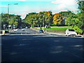
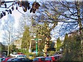
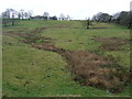
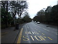
Photos of BL6 4NF


Area Information
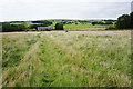
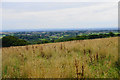
BL6 4NF is a small residential postcode in the Metropolitan Borough of Bolton, Greater Manchester, encompassing parts of the Heaton, Lostock, and Chew Moor wards. With a population of 1,573, it reflects a tight-knit suburban community, historically rooted in Lancashire. The area is characterised by a mix of residential properties and agricultural land, though the latter is limited to 18% of the total. Centred around coordinates 53.576727, -2.456056, it lies 3.5 miles west of Bolton town centre and 13 miles northwest of Manchester. The area’s heritage is evident in landmarks such as the Grade II* listed Lostock Hall gatehouse and the Church of St Mary. Daily life here is shaped by proximity to rail networks and local retail hubs, with a focus on community living. The predominantly suburban layout, combined with nearby amenities, makes BL6 4NF a practical choice for those seeking a balance between residential tranquillity and accessible urban connectivity.
- Area Type
- Postcode
- Area Size
- Not available
- Population
- 1573
- Population Density
- 1795 people/km²
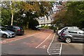
BL6 4NF is a predominantly owner-occupied area, with 93% of homes owned by residents rather than rented. The accommodation type is largely houses, which is typical for suburban settings. This high home ownership rate suggests a stable market with long-term residents, potentially limiting rental options for newcomers. The concentration of houses indicates a focus on family-friendly living, with properties likely offering more space and garden areas compared to apartments. However, the small size of the postcode means the housing stock is limited, and buyers should consider the immediate surrounding areas for broader options. The market’s character is defined by its residential nature, with limited commercial or mixed-use development.
House Prices in BL6 4NF
No properties found in this postcode.
Energy Efficiency in BL6 4NF
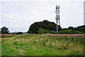
Residents of BL6 4NF have access to a range of amenities within walking or short driving distance. Retail options include major supermarkets such as Tesco Bolton, Heron Wigan, and Co-op Wigan, ensuring daily shopping needs are met. The rail network provides easy access to larger towns and cities, with stations like Lostock and Horwich Parkway offering frequent services. While the area lacks detailed information on parks or leisure facilities, its proximity to Middlebrook and historical landmarks like the Lostock Hall gatehouse suggests opportunities for outdoor activities. The character of the area is defined by its suburban charm, with a focus on community and practical living.
Amenities
Schools
The nearest school to BL6 4NF is Lostock Primary School, which holds an Ofsted rating of outstanding. As a primary school, it serves the needs of local children aged 4–11, offering a high standard of education. The absence of secondary schools in the immediate vicinity means families may need to consider commuting to nearby towns like Bolton or Wigan. The presence of a top-rated primary school is a significant advantage for families prioritising early education, though secondary schooling options are not listed in the data. This mix of school types reflects the area’s focus on primary education, with limited local provision for older students.
| Rank | School | Type | Entry gender | Ages |
|---|
Explore more schools in this area
Go to Schools tabDemographics
The population of BL6 4NF is predominantly adults aged 30-64, with a median age of 47. Home ownership is exceptionally high at 93%, reflecting a stable, long-term resident base. The area is composed largely of houses, with 69% of the population identifying as White, 26% Asian, and 1% Black. This demographic mix contributes to a diverse yet cohesive community. Single-person households account for 26% of the population, while 29% live with dependent children, indicating a blend of family and independent living. The high home ownership rate suggests a mature market with limited rental properties, which may influence property values and availability. The area’s age profile and household composition align with a suburban environment where families and professionals coexist.
Household Size
Accommodation Type
Tenure
Ethnic Group
Religion
Household Composition
Age
Household Deprivation
NS-SEC
Explore more demographic insights in this area
Go to Demographics tabPlanning
Planning Constraints
- Flood RiskPremium
- Ramsar Wetland SitesPremium
- Area of Outstanding Natural BeautyPremium
- Protected Nature ReservePremium
- Protected WoodlandPremium