Area Overview for BL6 4JE
Photos of BL6 4JE
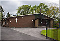
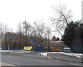
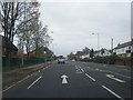
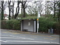
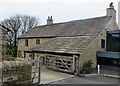
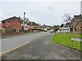
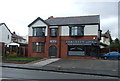
11 photos from this area
Area Information
Key information about the BL6 4JE including its size, population, and administrative classification.
- Area Type
- Postcode
- Area Size
- 3.3 hectares
- Population
- 1425
- Population Density
- 728 people/km²
House Prices in BL6 4JE
42
Properties
£256,261
Average Sold Price
£125,500
Lowest Price
£410,000
Highest Price
Showing 42 properties
| Address | Type | Beds | Baths | Last Sale Price | Last Sale Date | |
|---|---|---|---|---|---|---|
| 47 St Leonards Avenue, Lostock, Bolton, BL6 4JE | Detached | 4 | 1 | £390,000 | Dec 2023 | |
| 36 St Leonards Avenue, Lostock, Bolton, BL6 4JE | Retail | 3 | - | £315,000 | Mar 2022 | |
| 38 St Leonards Avenue, Lostock, Bolton, BL6 4JE | house | - | - | £310,500 | Apr 2021 | |
| 20 St Leonards Avenue, Lostock, Bolton, BL6 4JE | Detached | 5 | 1 | £410,000 | Dec 2020 | |
| 52 St Leonards Avenue, Lostock, Bolton, BL6 4JE | house | - | - | £231,000 | Aug 2019 | |
| 8 St Leonards Avenue, Lostock, Bolton, BL6 4JE | Bungalow | 3 | 2 | £256,795 | Aug 2019 | |
| 2 St Leonards Avenue, Lostock, Bolton, BL6 4JE | Detached | 4 | 2 | £262,000 | Apr 2019 | |
| 32 St Leonards Avenue, Lostock, Bolton, BL6 4JE | house | - | - | £223,000 | Oct 2017 | |
| 71 St Leonards Avenue, Lostock, Bolton, BL6 4JE | Detached | 5 | 1 | £355,000 | Aug 2017 | |
| 14 St Leonards Avenue, Lostock, Bolton, BL6 4JE | Detached | 4 | 1 | £278,000 | Aug 2017 |
Page 1 of 5
Energy Efficiency in BL6 4JE
Amenities
Schools
| Rank | School | Type | Entry gender | Ages |
|---|
Explore more schools in this area
Go to Schools tabDemographics
Household Size
Two person
most common
Accommodation Type
Houses
most common
Tenure
92
majority
Ethnic Group
White
most common
Religion
N/A
most common
Household Composition
N/A
most common
Age
47
median
Adults (30-64 years)
most common
Household Deprivation
N/A
with no deprivation
NS-SEC
54
in Lower managerial occupations
Explore more demographic insights in this area
Go to Demographics tabPlanning
Planning Constraints
- Flood RiskPremium
- Ramsar Wetland SitesPremium
- Area of Outstanding Natural BeautyPremium
- Protected Nature ReservePremium
- Protected WoodlandPremium