Area Overview for BL6 4AW
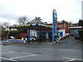
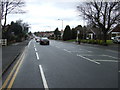
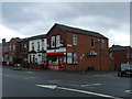
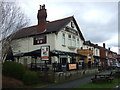
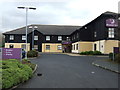
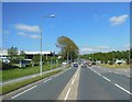
Photos of BL6 4AW

Area Information
The postcode BL6 4AW is a specific residential cluster located within the larger town of Horwich in the Metropolitan Borough of Bolton. This small defined area covers 8,903 square metres and serves a population of 2,326 residents. You are looking at a property setting that offers direct access to the broader infrastructure of Horwich while maintaining a contained footprint. The location sits approximately at coordinates 53.5935°N, 2.5164°W, placing it firmly in the North West of England. Historically, the wider Horwich area originated as a medieval hunting chase before developing significantly with the arrival of railway workshops in the 19th century. Today, the BL6 4AW postcode serves as a small residential slice of this larger parish with a population history that includes significant shifts from 3,500 to 13,000 inhabitants in the 1890s. Living in BL6 4AW means being part of a specific housing cluster that benefits from the town's established transport links and local services. The area reflects the administrative history of Horwich, which gained town status in 1974 upon transfer to Greater Manchester. You are purchasing a home in a location that blends historical roots with modern connectivity. The specific nature of this postcode suggests a dense but manageable living environment within a respectable housing market.
- Area Type
- Postcode
- Area Size
- 8903 m²
- Population
- 2326
- Population Density
- 313 people/km²
The property market in BL6 4AW is characterised almost entirely by long-term ownership rather than short-term tenancy. With 83% of homes occupied by their owners, this area functions distinctly as an owner-occupied community. The predominant accommodation type for your search is Houses, which shapes the visual character of the streets and the nature of the transactions you might encounter. You will find that the housing stock is comprised mainly of residential clusters suited to families and established couples. This high ownership rate means fewer new listings enter the market periodically compared to high-tenure estates, and prices often reflect significant equity investment by current residents. When evaluating homes in BL6 4AW, expect a market driven by homeowners looking to move on or upgrade within the same locality. The mix of properties will largely reflect the needs of the 47-year-old median resident and the 30-to-64-year-old adult demographic. Rental properties are rare in this specific cluster, making competition among buyers potentially fierce for available stock. The area does not offer the luxury of browsing a wide selection of recently vacated rental units or new-build apartments. Instead, you are entering a market where houses have generally been inherited, renovated, or maintained by previous generations.
House Prices in BL6 4AW
Showing 4 properties
| Address | Type | Beds | Baths | Last Sale Price | Last Sale Date | |
|---|---|---|---|---|---|---|
| 24 Ox Hey Lane, Lostock, Bolton, BL6 4AW | Semi-detached | 4 | 2 | £465,000 | Jan 2021 | |
| 22 Ox Hey Lane, Lostock, Bolton, BL6 4AW | Semi-detached | 3 | 1 | £245,000 | Mar 2016 | |
| 18 Ox Hey Lane, Lostock, Bolton, BL6 4AW | Semi-detached | - | - | £204,000 | May 2009 | |
| 20 Ox Hey Lane, Lostock, Bolton, BL6 4AW | Terraced | - | - | £59,950 | May 1995 |
Energy Efficiency in BL6 4AW
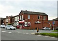
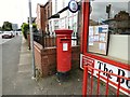
Daily life in BL6 4AW is supported by a convenient network of amenities and retail venues nearby. You have easy access to five major retail locations, specifically including Tesco Bolton, Asda Horwich, and M&S Middlebrook. These supermarkets offer the essentials and a wide range of goods without requiring long journeys. Transport options further enhance your lifestyle with five nearby railway stations, such as Horwich Parkway and Westhoughton, facilitating easy travel for leisure and business. The locale of Horwich itself offers historical depth, dating back to a 1221 reference as Horewic, with a heritage centre available for local visits. While the immediate BL6 4AW cluster is residential, the surrounding town centre provides the essential social fabric. You can find dining and leisure options within the broader Horwich area, which lies at the coordinates 53.5935°N, 2.5164°W. The presence of notable sites like Holy Trinity Church and the New Chapel adds cultural interest to your surroundings. Living here means balancing a modern, connected lifestyle with access to the deeper history of Lancashire.
Amenities
Schools
Families looking at homes in BL6 4AW will find limited educational options immediately adjacent to their specific cluster but excellent nearby sixth-form provision. The primary educational data available for this specific postcode does not list infant or junior schools located directly within the BL6 4AW boundaries. The nearest significant educational facility identified in the local data is Bolton Wanderers Free School. This institution operates as a sixth-form college, serving older students preparing for higher education or apprenticeships. For primary-aged children, families will likely need to commute slightly further to access specific provisions not explicitly listed in the immediate BL6 4AW data. The presence of a dedicated sixth-form college highlights that the broader Horwich area supports advanced educational pathways beyond secondary school. You should verify specific catchment zones for younger children with the local council, as the data only confirms the nearby existence of Bolton Wanderers Free School. The educational landscape here prioritises the transition into adult life and post-secondary training.
| Rank | School | Type | Entry gender | Ages |
|---|
Explore more schools in this area
Go to Schools tabDemographics
Residents of BL6 4AW form a community defined by stability and age. The median age in this area is 47 years, meaning the typical household comprises older adults rather than young families or students. The most common age range sits firmly within Adults, specifically those between 30 and 64 years of age. You are looking at an area where home ownership is the norm, with an impressive 83% of properties occupied by owners rather than tenants. This high rate suggests a settled community where people have built long-term roots in their homes. The predominant accommodation type consists of Houses, which aligns with the age profile and ownership statistics. The most prominent ethnic group in the area is White, reflecting the broader demographic areas of North West England. This demographic makeup creates a neighbourhood where established residents often live alongside their families. The population density stands at 313 people per square kilometre, indicating a moderate concentration of households. Those considering homes in BL6 4AW can expect a quiet residential atmosphere dominated by older, owner-occupied family homes. The social fabric here is built on longevity rather than transient populations.
Household Size
Accommodation Type
Tenure
Ethnic Group
Religion
Household Composition
Age
Household Deprivation
NS-SEC
Explore more demographic insights in this area
Go to Demographics tabPlanning
Planning Constraints
- Flood RiskPremium
- Ramsar Wetland SitesPremium
- Area of Outstanding Natural BeautyPremium
- Protected Nature ReservePremium
- Protected WoodlandPremium