Area Overview for BL6 4AU
Photos of BL6 4AU
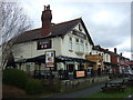
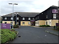
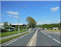
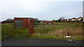
31 photos from this area
Area Information
Key information about the BL6 4AU including its size, population, and administrative classification.
- Area Type
- Postcode
- Area Size
- 7623 m²
- Population
- 2326
- Population Density
- 313 people/km²
House Prices in BL6 4AU
46
Properties
£104,687
Average Sold Price
£8,500
Lowest Price
£205,000
Highest Price
Showing 46 properties
| Address | Type | Beds | Baths | Last Sale Price | Last Sale Date | |
|---|---|---|---|---|---|---|
| 15 Cambridge Road, Lostock, Bolton, BL6 4AU | Terraced | 3 | 1 | £189,995 | Mar 2025 | |
| 14 Cambridge Road, Lostock, Bolton, BL6 4AU | Terraced | 2 | 1 | £124,000 | May 2024 | |
| 36 Cambridge Road, Lostock, Bolton, BL6 4AU | house | 2 | 1 | £122,000 | Oct 2022 | |
| 35 Cambridge Road, Lostock, Bolton, BL6 4AU | house | - | - | £205,000 | Dec 2021 | |
| 17 Cambridge Road, Lostock, Bolton, BL6 4AU | Semi-detached | 3 | 1 | £188,000 | Aug 2021 | |
| 1 Cambridge Road, Lostock, Bolton, BL6 4AU | house | - | - | £166,000 | Nov 2020 | |
| 16 Cambridge Road, Lostock, Bolton, BL6 4AU | Terraced | 2 | 1 | £110,000 | Oct 2020 | |
| 28 Cambridge Road, Lostock, Bolton, BL6 4AU | Terraced | 2 | 1 | £105,000 | Jun 2020 | |
| 4 Cambridge Road, Lostock, Bolton, BL6 4AU | Terraced | 2 | 1 | £107,500 | Aug 2019 | |
| 24 Cambridge Road, Lostock, Bolton, BL6 4AU | Terraced | 2 | 1 | £90,000 | Jul 2019 |
Page 1 of 5
Energy Efficiency in BL6 4AU
Amenities
Schools
| Rank | School | Type | Entry gender | Ages |
|---|
Explore more schools in this area
Go to Schools tabDemographics
Household Size
Family (3-5 people)
most common
Accommodation Type
Houses
most common
Tenure
83
majority
Ethnic Group
White
most common
Religion
N/A
most common
Household Composition
N/A
most common
Age
47
median
Adults (30-64 years)
most common
Household Deprivation
N/A
with no deprivation
NS-SEC
43
in Lower managerial occupations
Explore more demographic insights in this area
Go to Demographics tabPlanning
Planning Constraints
- Flood RiskPremium
- Ramsar Wetland SitesPremium
- Area of Outstanding Natural BeautyPremium
- Protected Nature ReservePremium
- Protected WoodlandPremium