Area Overview for BL5 3XB
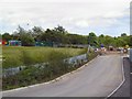
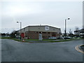
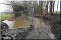
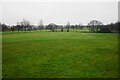
Photos of BL5 3XB


Area Information
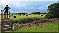
Living in BL5 3XB means being part of a compact, residential cluster in England’s Greater Manchester region. The area covers 6,945 square metres and is home to 1,822 people, with a population density of 340 people per square kilometre. This small postcode area, part of the Borough of Bolton, has a long history as a civil parish, with roots tracing back to the 12th century. It is characterised by a mix of historic and modern features, including St Bartholomew’s Parish Church, built in 1871, and the Red Lion Inn, dating to 1608. Daily life here is shaped by proximity to local amenities, with five rail stations within practical reach and a range of retail options. Families are well-served by three primary schools, including The Gates Primary School, which holds a ‘good’ Ofsted rating. The area’s small size means a tight-knit community feel, though buyers should consider its limited housing stock and the need for nearby transport links.
- Area Type
- Postcode
- Area Size
- 6945 m²
- Population
- 1822
- Population Density
- 340 people/km²
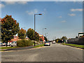
BL5 3XB is predominantly an owner-occupied area, with 60% of residents living in homes they own. The housing stock is dominated by houses rather than flats or apartments, reflecting a suburban or semi-rural character. Given the area’s small size, the property market is likely limited in scale, with few new developments. Buyers should consider the proximity to local amenities and transport links, as the area’s appeal may hinge on its practicality rather than luxury. The dominance of owner-occupied homes suggests a community of long-term residents, which could influence property values and market dynamics. Those seeking investment opportunities may find competition fierce, given the limited supply of homes.
House Prices in BL5 3XB
No properties found in this postcode.
Energy Efficiency in BL5 3XB
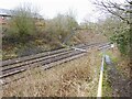
BL5 3XB offers a practical lifestyle with nearby amenities that cater to daily needs. Residents have access to five rail stations, including Westhoughton and Horwich Parkway, providing efficient links to surrounding areas. For shopping, the area is served by retail outlets such as Lidl Westhoughton, The Southern Co-operative Co, and Aldi 29, ensuring convenience for groceries and essentials. While specific parks or leisure facilities are not detailed in the data, the proximity to rail and retail suggests a focus on functionality over expansive recreational spaces. The area’s small size means amenities are compact, but the availability of essential services supports a self-contained lifestyle.
Amenities
Schools
Residents of BL5 3XB have access to three primary schools within practical reach. These include Fourgates Primary School and St John’s CofE Primary School, Wingates, both of which cater to younger children. The Gates Primary School, also in the area, holds a ‘good’ Ofsted rating, offering families a reliable option for early education. The presence of multiple primary schools ensures that children have choices, though the absence of secondary schools nearby may require commuting. The variety of school types, including both state and church-affiliated institutions, reflects the area’s diverse educational landscape. For families prioritising school quality, The Gates Primary School’s rating is a notable advantage.
| Rank | School | Type | Entry gender | Ages |
|---|
Explore more schools in this area
Go to Schools tabDemographics
The population of BL5 3XB has a median age of 47, with the majority of residents falling within the 30-64 age range. This suggests a community of established adults, many of whom may be in their prime working years or nearing retirement. Home ownership is high at 60%, with houses being the predominant type of accommodation. The predominant ethnic group is White, reflecting a largely homogenous demographic. While specific data on deprivation is not provided, the age profile and home ownership rates indicate a stable, settled population. The absence of detailed diversity metrics means the area’s social composition remains less defined, but the focus on owner-occupied homes suggests a preference for long-term residency over transient rental markets.
Household Size
Accommodation Type
Tenure
Ethnic Group
Religion
Household Composition
Age
Household Deprivation
NS-SEC
Explore more demographic insights in this area
Go to Demographics tabPlanning
Planning Constraints
- Flood RiskPremium
- Ramsar Wetland SitesPremium
- Area of Outstanding Natural BeautyPremium
- Protected Nature ReservePremium
- Protected WoodlandPremium