Area Overview for BL5 3NJ
Photos of BL5 3NJ
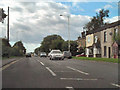
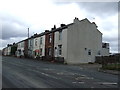
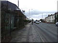
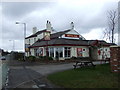
33 photos from this area
Area Information
Key information about the BL5 3NJ including its size, population, and administrative classification.
- Area Type
- Postcode
- Area Size
- 30.3 hectares
- Population
- 2326
- Population Density
- 313 people/km²
House Prices in BL5 3NJ
42
Properties
£142,654
Average Sold Price
£55,000
Lowest Price
£470,000
Highest Price
Showing 42 properties
| Address | Type | Beds | Baths | Last Sale Price | Last Sale Date | |
|---|---|---|---|---|---|---|
| 616 Chorley Road, Westhoughton, Bolton, BL5 3NJ | Terraced | 3 | 1 | £225,000 | Jun 2025 | |
| 625 Chorley Road, Westhoughton, Bolton, BL5 3NJ | Terraced | 2 | 1 | £190,000 | Mar 2025 | |
| 644 Chorley Road, Westhoughton, Bolton, BL5 3NJ | Terraced | 2 | 1 | £176,050 | Jan 2024 | |
| 621 Chorley Road, Westhoughton, Bolton, BL5 3NJ | Terraced | 2 | 1 | £135,000 | Dec 2023 | |
| 623 Chorley Road, Westhoughton, Bolton, BL5 3NJ | house | - | - | £170,000 | May 2023 | |
| 619 Chorley Road, Westhoughton, Bolton, BL5 3NJ | house | - | - | £125,000 | Sep 2021 | |
| 642 Chorley Road, Westhoughton, Bolton, BL5 3NJ | house | - | - | £176,000 | Sep 2021 | |
| 627 Chorley Road, Westhoughton, Bolton, BL5 3NJ | house | - | - | £155,000 | May 2021 | |
| 617 Chorley Road, Westhoughton, Bolton, BL5 3NJ | Terraced | 2 | 2 | £135,000 | Mar 2021 | |
| 624 Chorley Road, Westhoughton, Bolton, BL5 3NJ | house | 2 | - | £153,000 | Feb 2021 |
Page 1 of 5
Energy Efficiency in BL5 3NJ
Amenities
Schools
| Rank | School | Type | Entry gender | Ages |
|---|
Explore more schools in this area
Go to Schools tabDemographics
Household Size
Family (3-5 people)
most common
Accommodation Type
Houses
most common
Tenure
83
majority
Ethnic Group
White
most common
Religion
N/A
most common
Household Composition
N/A
most common
Age
47
median
Adults (30-64 years)
most common
Household Deprivation
N/A
with no deprivation
NS-SEC
43
in Lower managerial occupations
Explore more demographic insights in this area
Go to Demographics tabPlanning
Planning Constraints
- Flood RiskPremium
- Ramsar Wetland SitesPremium
- Area of Outstanding Natural BeautyPremium
- Protected Nature ReservePremium
- Protected WoodlandPremium