Area Overview for BL5 2TF
Photos of BL5 2TF
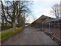
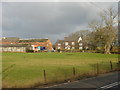

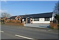

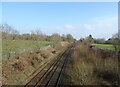
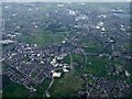
12 photos from this area
Area Information
Key information about the BL5 2TF including its size, population, and administrative classification.
- Area Type
- Postcode
- Area Size
- 38.9 hectares
- Population
- 2539
- Population Density
- 2354 people/km²
House Prices in BL5 2TF
48
Properties
£297,592
Average Sold Price
£133,000
Lowest Price
£3,902,021
Highest Price
Showing 48 properties
| Address | Type | Beds | Baths | Last Sale Price | Last Sale Date | |
|---|---|---|---|---|---|---|
| 70 Hydrangea Close, Westhoughton, Bolton, BL5 2TF | Terraced | 3 | - | £200,000 | Sep 2024 | |
| 60 Hydrangea Close, Westhoughton, Bolton, BL5 2TF | Terraced | 3 | - | £195,000 | Jun 2023 | |
| 34 Hydrangea Close, Westhoughton, Bolton, BL5 2TF | Detached | 3 | 3 | £220,000 | Sep 2022 | |
| 26 Hydrangea Close, Westhoughton, Bolton, BL5 2TF | Detached | 5 | 3 | £435,000 | Aug 2022 | |
| 64 Hydrangea Close, Westhoughton, Bolton, BL5 2TF | house | 3 | 3 | £200,000 | Jun 2022 | |
| 54 Hydrangea Close, Westhoughton, Bolton, BL5 2TF | house | 6 | 3 | £380,000 | May 2022 | |
| 44 Hydrangea Close, Westhoughton, Bolton, BL5 2TF | Semi-detached | 3 | - | £185,000 | Sep 2021 | |
| 66 Hydrangea Close, Westhoughton, Bolton, BL5 2TF | Terraced | 3 | 2 | £185,000 | Sep 2021 | |
| 30 Hydrangea Close, Westhoughton, Bolton, BL5 2TF | house | - | - | £208,000 | Jul 2021 | |
| 72 Hydrangea Close, Westhoughton, Bolton, BL5 2TF | Semi-detached | 4 | 3 | £199,000 | Jun 2021 |
Page 1 of 5
Energy Efficiency in BL5 2TF
Amenities
Schools
| Rank | School | Type | Entry gender | Ages |
|---|
Explore more schools in this area
Go to Schools tabDemographics
Household Size
Family (3-5 people)
most common
Accommodation Type
Houses
most common
Tenure
59
majority
Ethnic Group
White
most common
Religion
N/A
most common
Household Composition
N/A
most common
Age
47
median
Adults (30-64 years)
most common
Household Deprivation
N/A
with no deprivation
NS-SEC
27
in Lower managerial occupations
Explore more demographic insights in this area
Go to Demographics tabPlanning
Planning Constraints
- Flood RiskPremium
- Ramsar Wetland SitesPremium
- Area of Outstanding Natural BeautyPremium
- Protected Nature ReservePremium
- Protected WoodlandPremium