Area Overview for BL4 9PL
Photos of BL4 9PL


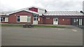
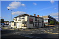
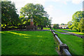
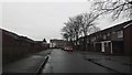

44 photos from this area
Area Information
Key information about the BL4 9PL including its size, population, and administrative classification.
- Area Type
- Postcode
- Area Size
- 5401 m²
- Population
- Not available
- Population Density
- Not available
House Prices in BL4 9PL
14
Properties
£137,244
Average Sold Price
£78,000
Lowest Price
£250,000
Highest Price
Showing 14 properties
| Address | Type | Beds | Baths | Last Sale Price | Last Sale Date | |
|---|---|---|---|---|---|---|
| 147 Piggott Street, Farnworth, Bolton, BL4 9PL | Semi-detached | 4 | 1 | £250,000 | Jul 2025 | |
| 157 Piggott Street, Farnworth, Bolton, BL4 9PL | house | - | - | £175,000 | Mar 2024 | |
| 149 Piggott Street, Farnworth, Bolton, BL4 9PL | house | - | - | £185,000 | Oct 2022 | |
| 155 Piggott Street, Farnworth, Bolton, BL4 9PL | Semi-detached | 4 | 1 | £168,495 | Jan 2020 | |
| 161 Piggott Street, Farnworth, Bolton, BL4 9PL | Semi-detached | 3 | - | £129,995 | Mar 2018 | |
| 169 Piggott Street, Farnworth, Bolton, BL4 9PL | Bungalow | 2 | 1 | £107,000 | Oct 2014 | |
| 159 Piggott Street, Farnworth, Bolton, BL4 9PL | Semi-detached | 4 | 1 | £78,000 | Nov 2013 | |
| 151 Piggott Street, Farnworth, Bolton, BL4 9PL | house | 3 | - | £86,000 | Aug 2010 | |
| 165 Piggott Street, Farnworth, Bolton, BL4 9PL | house | - | - | £110,000 | Oct 2007 | |
| 177-179 Piggott Street, Farnworth, Bolton, BL4 9PL | Semi-detached | - | - | £82,950 | Jun 2003 |
Page 1 of 2
Energy Efficiency in BL4 9PL
Amenities
Schools
| Rank | School | Type | Entry gender | Ages |
|---|
Explore more schools in this area
Go to Schools tabDemographics
Household Size
Family (3-5 people)
most common
Accommodation Type
Houses
most common
Tenure
37
majority
Ethnic Group
White
most common
Religion
N/A
most common
Household Composition
N/A
most common
Age
47
median
Adults (30-64 years)
most common
Household Deprivation
N/A
with no deprivation
NS-SEC
14
in Lower managerial occupations
Explore more demographic insights in this area
Go to Demographics tabPlanning
Planning Constraints
- Flood RiskPremium
- Ramsar Wetland SitesPremium
- Area of Outstanding Natural BeautyPremium
- Protected Nature ReservePremium
- Protected WoodlandPremium