Area Overview for BL4 9LW
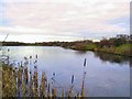
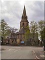
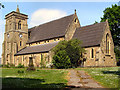
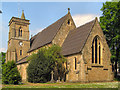
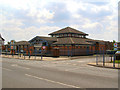
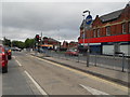
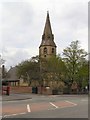
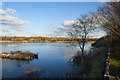
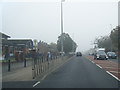
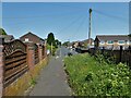
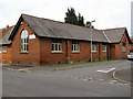
Photos of BL4 9LW

Area Information
Living in BL4 9LW offers a distinct residential experience within a small cluster that houses a population of 2639 people. This postcode area represents a specific residential snapshot where daily life unfolds without the overwhelming scale of larger urban districts. You will find yourself in a community defined by clear boundaries and a focused demographic profile. The area is situated in England and functions as a contained neighbourhood where residents navigate their local environment with ease. There are no hidden complexities regarding the geographic layout; the territory is compact and accessible. You purchase into a space where the social fabric is established by the people currently calling the homes here home. The character of BL4 9LW is shaped by these 2639 individuals who make up the entire local demographic. Understanding what it means to live here requires recognition of this finite and specific community structure. You gain immediate familiarity with the residents because the numbers are so tangible. The lack of massive population centres nearby means that your interactions are likely to remain within manageable social circles. This area stands as a self-contained unit where every house and street contributes to the whole.
- Area Type
- Postcode
- Area Size
- Not available
- Population
- 2639
- Population Density
- 3667 people/km²
The property market in BL4 9LW is heavily skewed towards owner-occupied homes, with 56 per cent of houses held by their occupants. This statistic indicates that the local housing stock is characterised by stability rather than transient tenancies. Houses constitute the main accommodation type, meaning you will primarily find detached or semi-detached properties rather than flats or purpose-built apartments. This housing style suits the median age of 47 and the preference of the majority of residents who have chosen to buy rather than rent. When you search for homes in this area, you are entering a market defined by private ownership and long-term residency. The low figure for rental properties means there is less turnover and a more settled atmosphere. Buyers looking at this postcode should expect to compete with other owners who value their properties deeply. The dominance of houses over other dwelling types simplifies your search, as you need not look for alternative configurations. This market structure is ideal for those seeking a permanent grid in a specific postcode.
House Prices in BL4 9LW
No properties found in this postcode.
Energy Efficiency in BL4 9LW
Your daily lifestyle in BL4 9LW extends seamlessly to various practical amenities within reasonable reach. For your shopping needs, Iceland Walkden, M&S Walkden, and Aldi Whittle are the notable retail outlets you can easily access. These stores provide a full range of groceries and household essentials close to residential zones. If you require public transport, the area is well linked to Walkden Railway Station, Farnworth Railway Station, and Kearsley Railway Station. You can choose from five rail options nearby to fit your travel schedule. Bus connectivity is further enhanced by routes serving Radcliffe, Ladywell, and Whitefield via the metro network. City Airport Manchester is also within reach, offering international travel convenience without complex transfers. This combination of retail and transport options means you rarely need to leave the immediate region for basic necessities or short trips. The presence of these specific venues ensures that your daily errands are efficiently managed.
Amenities
Schools
North Walkden Primary School is the nearest educational facility to BL4 9LW. This institution operates as a primary school and holds an Ofsted rating of satisfactory. You will find this school serving the immediate catchment area for young children in the vicinity. The existence of a single listed primary option indicates that young families living here typically utilise this specific resource or travel to other local institutions. The satisfactory rating provides a baseline indication of the school's current performance standards. While only one primary school is listed in the available data, it serves as the key educational reference point for this residential cluster. Families with children in the 30 to 64 year age group, who form the most common age range, will rely heavily on this facility. The school's location and rating are concrete facts that prospective parents can verify during their research into schools near BL4 9LW. There are no secondary schools listed in the provided data for this specific vicinity, meaning further education choices lie beyond the immediate boundary of this postcode.
| Rank | School | Type | Entry gender | Ages |
|---|
Explore more schools in this area
Go to Schools tabDemographics
The community profile of BL4 9LW is dominated by adults between the ages of 30 and 64 years. The median age in the area sits at 47 years, indicating a mature population. Over half of the residents, specifically 56 per cent, own their homes outright. This figure suggests a high level of stability and long-term settlement within the postcode. Houses form the primary accommodation type, which aligns with the ownership statistics and the age profile of the inhabitants. The predominant ethnic group is White, reflecting a specific cultural composition that defines the local demographic character. You are entering a neighbourhood where the majority of residents have passed their mid-years and have likely been settled for some time. The high proportion of owner-occupiers means that properties are frequently passed down or purchased for long stays rather than short-term rentals. This demographic reality shapes the pace of life and the nature of neighbourly interactions. The age distribution confirms that this is an area for established families and individuals seeking permanence.
Household Size
Accommodation Type
Tenure
Ethnic Group
Religion
Household Composition
Age
Household Deprivation
NS-SEC
Explore more demographic insights in this area
Go to Demographics tabPlanning
Planning Constraints
- Flood RiskPremium
- Ramsar Wetland SitesPremium
- Area of Outstanding Natural BeautyPremium
- Protected Nature ReservePremium
- Protected WoodlandPremium