Area Overview for BL4 9JP
Photos of BL4 9JP
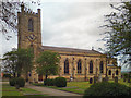
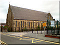
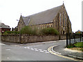
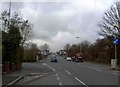
57 photos from this area
Area Information
Key information about the BL4 9JP including its size, population, and administrative classification.
- Area Type
- Postcode
- Area Size
- 5352 m²
- Population
- 1847
- Population Density
- 4201 people/km²
House Prices in BL4 9JP
40
Properties
£77,188
Average Sold Price
£17,000
Lowest Price
£136,000
Highest Price
Showing 40 properties
| Address | Type | Beds | Baths | Last Sale Price | Last Sale Date | |
|---|---|---|---|---|---|---|
| 220 Bradford Street, Farnworth, Bolton, BL4 9JP | house | 2 | 1 | £127,000 | Oct 2025 | |
| 133 Bradford Street, Farnworth, Bolton, BL4 9JP | Terraced | 2 | 1 | £117,500 | Aug 2025 | |
| 200 Bradford Street, Farnworth, Bolton, BL4 9JP | Terraced | 2 | 1 | £109,000 | Dec 2024 | |
| 137 Bradford Street, Farnworth, Bolton, BL4 9JP | Terraced | 3 | 1 | £136,000 | Oct 2023 | |
| 141 Bradford Street, Farnworth, Bolton, BL4 9JP | Terraced | 2 | 1 | £130,000 | May 2023 | |
| 149 Bradford Street, Farnworth, Bolton, BL4 9JP | house | - | - | £90,000 | Feb 2023 | |
| 147 Bradford Street, Farnworth, Bolton, BL4 9JP | house | - | - | £102,500 | Feb 2023 | |
| 198 Bradford Street, Farnworth, Bolton, BL4 9JP | Retail | 2 | - | £122,000 | Jul 2022 | |
| 210 Bradford Street, Farnworth, Bolton, BL4 9JP | Terraced | 2 | 1 | £104,000 | Apr 2022 | |
| 222 Bradford Street, Farnworth, Bolton, BL4 9JP | Terraced | 2 | 1 | £65,000 | Mar 2021 |
Page 1 of 4
Energy Efficiency in BL4 9JP
Amenities
Schools
| Rank | School | Type | Entry gender | Ages |
|---|
Explore more schools in this area
Go to Schools tabDemographics
Household Size
One person
most common
Accommodation Type
Houses
most common
Tenure
58
majority
Ethnic Group
White
most common
Religion
N/A
most common
Household Composition
N/A
most common
Age
47
median
Adults (30-64 years)
most common
Household Deprivation
N/A
with no deprivation
NS-SEC
20
in Lower managerial occupations
Explore more demographic insights in this area
Go to Demographics tabPlanning
Planning Constraints
- Flood RiskPremium
- Ramsar Wetland SitesPremium
- Area of Outstanding Natural BeautyPremium
- Protected Nature ReservePremium
- Protected WoodlandPremium